Sites and Monuments Record · Ireland
Ringfort - rath
Garraun (Ballysheehan Par.),Kilballyherberry, County Tipperary South, Ireland
The record
- Townland
- Garraun (Ballysheehan Par.),Kilballyherberry
- County
- Tipperary South
- Country
- Ireland
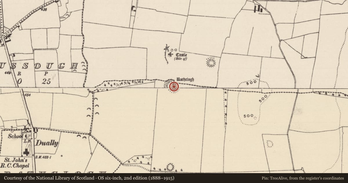
- First-edition OS map
- Hachured
- Latest-edition OS map
- Rathclogh
- Coordinates
- 52.54420, -7.80547
- SMR number
- TS053-076----
Slide toward Today to fade the historical sheet and see the modern map underneath.
David Rumsey Map Collection, Stanford LibrariesDavid Rumsey Map Collection, Stanford LibrariesDavid Rumsey Map Collection, Stanford LibrariesDavid Rumsey Map Collection, Stanford Libraries
4 historical maps cover this location, the earliest the 1790 map "Composite: Ireland." (David Rumsey Map Collection, Stanford Libraries).
Historical maps covering this location
- 1790 · Composite: Ireland. (David Rumsey Map Collection, Stanford Libraries)
- 1882 · Ireland (southern half). (David Rumsey Map Collection, Stanford Libraries)
- 1891 · Ireland 16 (David Rumsey Map Collection, Stanford Libraries)
- 1904 · Sheet 13. (David Rumsey Map Collection, Stanford Libraries)
This record in the National Monuments Service's Historic Environment Viewer ↗
The National Monuments Service's description
In grassland on top of a N-S ridge in upland area with good views in all directions. Motte and bailey (TS053-075----) 150m to N and ringfort (TS053-077----) 150m to NE and another ringfort (TS061-40----) 400m to S. Impressive ringfort consisting of a raised circular area (int. diam. 31m N-S; 32m E-W) enclosed by an earth and stone bank (top Wth 4m; base Wth 7m; int. H 0.6-1m; ext. H 3-5m) which gently slopes down into the interior, outer fosse (top Wth 9m; base Wth 3m; ext. D 1.6m) and possible outer bank (top Wth 4m; base Wth 4m; ext. H 1m) only visible from NW through N to NE where it is incorporated as a townland boundary. Causewayed entrance (Wth 4.5m) at E. Inner bank, fosse and outer bank have been quarried out at SSE quadrant of ringfort. This ringfort is not typical of other ringforts mentioned above given its hilltop location and defensive morphology.
Compiled by: Jean Farrelly
Date of upload: 26 August 2011
Nearby in the register
- Castle - motte and baileyunder 1 mi
- Ringfort - rathunder 1 mi
- Ringfort - rathunder 1 mi
- Fulacht fiaunder 1 mi
Other entries of the same register within about three miles of this one, by straight line.