Sites and Monuments Record · Ireland
Castle - ringwork
Castlemoyle North,Thurlesbeg, County Tipperary South, Ireland
The record
- Townland
- Castlemoyle North,Thurlesbeg
- County
- Tipperary South
- Country
- Ireland
- First-edition OS map
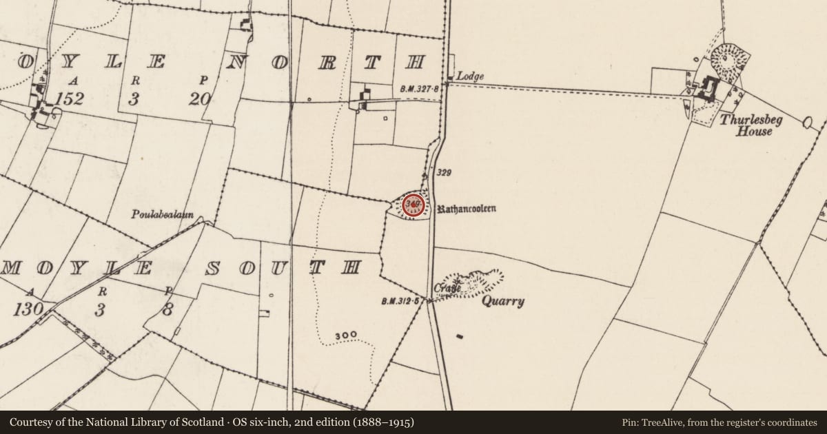
- Rathancooleen
- Latest-edition OS map
- Rathancooleen
- Coordinates
- 52.56128, -7.89542
- SMR number
- TS053-038----
Slide toward Today to fade the historical sheet and see the modern map underneath.
David Rumsey Map Collection, Stanford LibrariesDavid Rumsey Map Collection, Stanford LibrariesDavid Rumsey Map Collection, Stanford LibrariesDavid Rumsey Map Collection, Stanford Libraries
4 historical maps cover this location, the earliest the 1790 map "Composite: Ireland." (David Rumsey Map Collection, Stanford Libraries).
Historical maps covering this location
- 1790 · Composite: Ireland. (David Rumsey Map Collection, Stanford Libraries)
- 1869 · Ireland. (David Rumsey Map Collection, Stanford Libraries)
- 1891 · Ireland 16 (David Rumsey Map Collection, Stanford Libraries)
- 1904 · Sheet 13. (David Rumsey Map Collection, Stanford Libraries)
This record in the National Monuments Service's Historic Environment Viewer ↗
The National Monuments Service's description
In grassland on top of a high rise of ground on SE facing slope with good views in all directions. Overgrown but impressive monument consisting of a raised circular area (int. diam. approx. 40m E-W) enclosed by a high, steep-sided earth and stone bank (base Wth 6m; top Wth 1.8m; ext. H 1-5m; int. H 0.5-1m), fosse (base Wth 2.5m; top Wth 8m; ext. D 1m) and wide flat-topped earth and stone bank (base Wth 7m; top Wth 5m; ext. H 1m; int. H 0.7-1m) with causewayed entrance (Wth 3.5m) at SE. Impressive but overgrown monument making detailed examination impossible. Scooped out interior with gently sloping inner face and steep-sided external face of enclosing bank. Outer face of bank is at its highest at N where it is very defensive and very steep which providing the monument with a very defensive element. The defensive nature of monument would suggest it is a ringwork. Modern road intersects fosse destroying outer bank at E on a N-S axis.
Compiled by: Jean Farrelly
Date of upload: 26 August 2011
Nearby in the register
- Ringfort - rathunder 1 mi
- Enclosureunder 1 mi
- Ringfort - rathunder 1 mi
- Ringfort - rathunder 1 mi
Other entries of the same register within about three miles of this one, by straight line.