Sites and Monuments Record · Ireland
Earthwork
Greenan, County Sligo, Ireland
The record
- Townland
- Greenan
- County
- Sligo
- Country
- Ireland
- Latest-edition OS map
- Indicated
- Coordinates
- 54.04344, -8.41870
- SMR number
- SL040-135003-
Slide toward Today to fade the historical sheet and see the modern map underneath.
David Rumsey Map Collection, Stanford LibrariesDavid Rumsey Map Collection, Stanford LibrariesDavid Rumsey Map Collection, Stanford LibrariesDavid Rumsey Map Collection, Stanford Libraries
4 historical maps cover this location, the earliest the 1790 map "Composite: Ireland." (David Rumsey Map Collection, Stanford Libraries).
Historical maps covering this location
- 1790 · Composite: Ireland. (David Rumsey Map Collection, Stanford Libraries)
- 1869 · Ireland. (David Rumsey Map Collection, Stanford Libraries)
- 1891 · Ireland 16 (David Rumsey Map Collection, Stanford Libraries)
- 1922 · Ireland - northern section. (David Rumsey Map Collection, Stanford Libraries)
This record in the National Monuments Service's Historic Environment Viewer ↗
The National Monuments Service's description
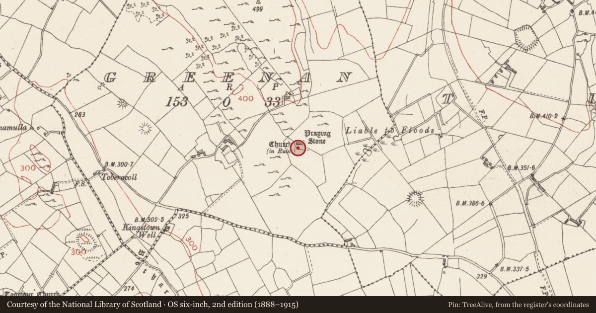
Immediately to the N of Greenan church (SL040-135001-) the ground is uneven and stony and traces of the outline of a semicircular area (c. 7.5m N-S), appended to the church, are evident. To the NW of the church, and dug into the low rise on which the church stands, is an anomalous subcircular sunken area (6m N-S; 6m E-W; D 0.8m), partially infilled with stone, and with a stony rim along its N side. There is a gap (Wth 1.4m) at W and another narrower gap (Wth 0.9m) at E which has traces of possible stone facing. The nature of this feature is unclear. Immediately to the E of the chancel is a narrow strip of ground (Wth c. 7m) defined by sod-covered wall footings (Wth 0.9m) on the N and E sides. This strip extends for a short distance along the E end of the S side of the church, c. 7m S of the church where it is defined by a barely discernible rise. Outside this strip, at a distance of 16m from the church and following a natural contour, is a shallow arc (c. 44m) of a ruined wall (Wth 0.8m) ESE-W, indicated on the 1914 edition of the OS 6-inch map, that may be the remnant of a larger enclosure.
Compiled by: Archaeological Survey Unit, UCC with revisions by Patrick F. O'Donovan and Paul Walsh
Date of upload: 20 June 2011
Nearby in the register
- Cross-slabunder 1 mi
- Churchunder 1 mi
- Road - road/trackwayunder 1 mi
- Souterrainunder 1 mi
Other entries of the same register within about three miles of this one, by straight line.