Sites and Monuments Record · Ireland
Ringfort - cashel
Greenan, County Sligo, Ireland
The record
- Townland
- Greenan
- County
- Sligo
- Country
- Ireland
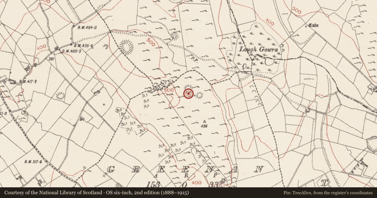
- Latest-edition OS map
- Hachured
- Coordinates
- 54.04826, -8.42151
- SMR number
- SL040-071001-
Slide toward Today to fade the historical sheet and see the modern map underneath.
David Rumsey Map Collection, Stanford LibrariesDavid Rumsey Map Collection, Stanford LibrariesDavid Rumsey Map Collection, Stanford LibrariesDavid Rumsey Map Collection, Stanford Libraries
4 historical maps cover this location, the earliest the 1790 map "Composite: Ireland." (David Rumsey Map Collection, Stanford Libraries).
Historical maps covering this location
- 1790 · Composite: Ireland. (David Rumsey Map Collection, Stanford Libraries)
- 1811 · Ireland. (David Rumsey Map Collection, Stanford Libraries)
- 1869 · Ireland. (David Rumsey Map Collection, Stanford Libraries)
- 1891 · Ireland 16 (David Rumsey Map Collection, Stanford Libraries)
This record in the National Monuments Service's Historic Environment Viewer ↗
The National Monuments Service's description
In rocky pasture, on a flat-topped rise overlooking Lough Gowra and within a field system (SL040-063001-). Conjoined along the E arc to an enclosure (SL040-071002-) which is located on a lower level. A raised oval area (int. diam. 20m x 17.2m) defined by two concentric ruinous stone walls and a short section of a third wall. The inner wall (Wth 5.2m; int. H 0.8m; ext. H 1.75m) of limestone slabs, boulders and rubble has a gap (Wth 2.8m) at N. The middle wall (Wth 1.5m; int. H 0.4m; ext. H 1.1m) forms the W arc of the conjoined enclosure and also has a gap at N. The inner and middle walls are 2m apart. An arc of outer wall (Wth 1.7m; int. H 0.4m; ext. H 0.55m) is evident 1.8m outside the middle wall SW-NW, merging with it at SW. The interior is strewn with sod-covered stones, possibly upcast from the souterrain (SL040-071003-) in the NE quadrant. A kerb circle (SL040-072----) lies c. 30m to SE.
The above description is derived from the published 'Archaeological Inventory of County Sligo' compiled by Ursula Egan, Elizabeth Byrne, Mary Sleeman with Sheila Ronan and Connie Murphy (Dublin Stationery Office, 2005).
Date of upload: 18 January 2008
Nearby in the register
- Souterrainunder 1 mi
- Enclosureunder 1 mi
- Kerb circleunder 1 mi
- Ringfort - cashelunder 1 mi
Other entries of the same register within about three miles of this one, by straight line.