Sites and Monuments Record · Ireland
Cross - High cross
Drumcolumb, County Sligo, Ireland
The record
- Townland
- Drumcolumb
- County
- Sligo
- Country
- Ireland
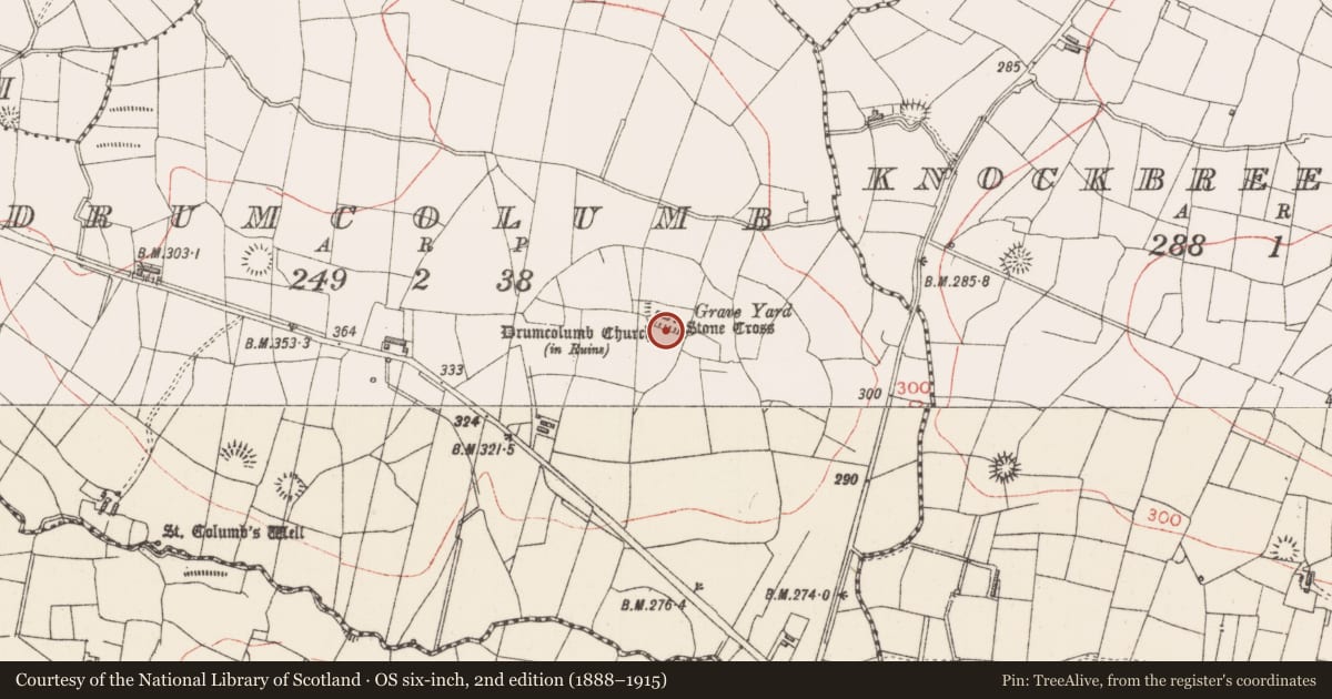
- Latest-edition OS map
- Stone Cross
- Coordinates
- 54.12901, -8.34764
- SMR number
- SL027-141003-
Slide toward Today to fade the historical sheet and see the modern map underneath.
David Rumsey Map Collection, Stanford LibrariesDavid Rumsey Map Collection, Stanford LibrariesDavid Rumsey Map Collection, Stanford LibrariesDavid Rumsey Map Collection, Stanford Libraries
4 historical maps cover this location, the earliest the 1790 map "Composite: Ireland." (David Rumsey Map Collection, Stanford Libraries).
Historical maps covering this location
- 1790 · Composite: Ireland. (David Rumsey Map Collection, Stanford Libraries)
- 1869 · Ireland. (David Rumsey Map Collection, Stanford Libraries)
- 1891 · Ireland 16 (David Rumsey Map Collection, Stanford Libraries)
- 1904 · Sheet 4. (David Rumsey Map Collection, Stanford Libraries)
This record in the National Monuments Service's Historic Environment Viewer ↗
The National Monuments Service's description
In the centre of a graveyard (SL027-141002-), 4m E of the ruin of Drumcolumb church (SL027-141001-) and within the N half of an ecclesiastical enclosure (SL027-141----). Described by Crawford (1918, 177) as the 'head of a plain cross with solid recessed ring… broken in two places'. A sketch from 1914 shows these two breaks, one above and the other below the ring (SMR (1989) file). The cross (H 0.5m; Wth 0.45m; T 0.1m), which is set upright in a low cairn of stones, is now eroded and weathered and the projecting arm above the ring (at the old break) has broken off. The arms project beyond the ring on one side but not on the other. Harbison (1992b, vol. 1, 74) noted that the four 'depressions' between the arms and the ring which are present on one face are only pecked out on the other face. He also stated that 'the cross-head could be later than 1200' (ibid.).
The above description is derived from the published 'Archaeological Inventory of County Sligo' compiled by Ursula Egan, Elizabeth Byrne, Mary Sleeman with Sheila Ronan and Connie Murphy (Dublin Stationery Office, 2005).
Date of upload: 18 January 2008
Nearby in the register
- Graveyardunder 1 mi
- Churchunder 1 mi
- Ecclesiastical enclosureunder 1 mi
- Ringfort - rathunder 1 mi
Other entries of the same register within about three miles of this one, by straight line.