Sites and Monuments Record · Ireland
Field system
Sheeanmore, County Sligo, Ireland
The record
- Townland
- Sheeanmore
- County
- Sligo
- Country
- Ireland
- Coordinates
- 54.26502, -8.70699
- SMR number
- SL013-111----
Slide toward Today to fade the historical sheet and see the modern map underneath.
David Rumsey Map Collection, Stanford LibrariesDavid Rumsey Map Collection, Stanford LibrariesDavid Rumsey Map Collection, Stanford LibrariesDavid Rumsey Map Collection, Stanford Libraries
4 historical maps cover this location, the earliest the 1790 map "Composite: Ireland." (David Rumsey Map Collection, Stanford Libraries).
Historical maps covering this location
- 1790 · Composite: Ireland. (David Rumsey Map Collection, Stanford Libraries)
- 1869 · Ireland. (David Rumsey Map Collection, Stanford Libraries)
- 1891 · Ireland 16 (David Rumsey Map Collection, Stanford Libraries)
- 1904 · Sheet 4. (David Rumsey Map Collection, Stanford Libraries)
This record in the National Monuments Service's Historic Environment Viewer ↗
The National Monuments Service's description
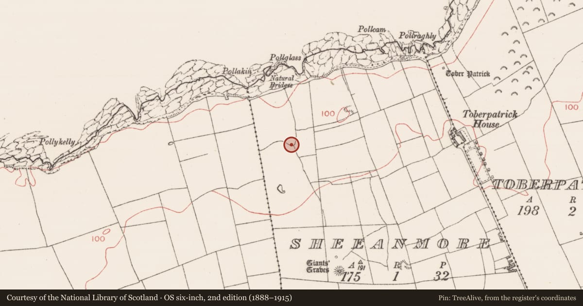
Situated on slight N-facing slope in gently undulating pasture to the N of Sheeanmore Hill. Field system is shown on the 1913 edition of the OS 6-inch map as a series of curving field boundaries. Two elements of the field system are most prominent. The first is a relic N-S orientated gently meandering boundary (L c. 250m) consisting of an earth and stone bank (Wth 3.2m; H 0.3m-0.5m) with a slight fosse/drain (Wth 0.5m; D 0.3m) on the E side. At the S end of this boundary, a series of E-W orientated boundaries are indicated on the OS 6-inch map but these have been levelled and are not visible at ground level. The second prominent element is a curving E-W orientated boundary (L 60m) linking to the W side of the main N-S boundary consisting of a relic low earthen bank (Wth 2.5m; H 0.3m) that lies on the top of a slight N facing natural scarp. The field system extends south into the archaeological complex on Sheeanmore hill (SL013:012002-; SL013-012003- and SL013-012004-).
Attached image: SL013-111----_01.JPG field bank
Compiled by: Mark Keegan
Date of upload: 19 January 2011
Nearby in the register
- Field systemunder 1 mi
- Barrow - mound barrowunder 1 mi
- Children's burial groundunder 1 mi
- Ritual site - holy wellunder 1 mi
Other entries of the same register within about three miles of this one, by straight line.