Sites and Monuments Record · Ireland
Children's burial ground
Sheeanmore, County Sligo, Ireland
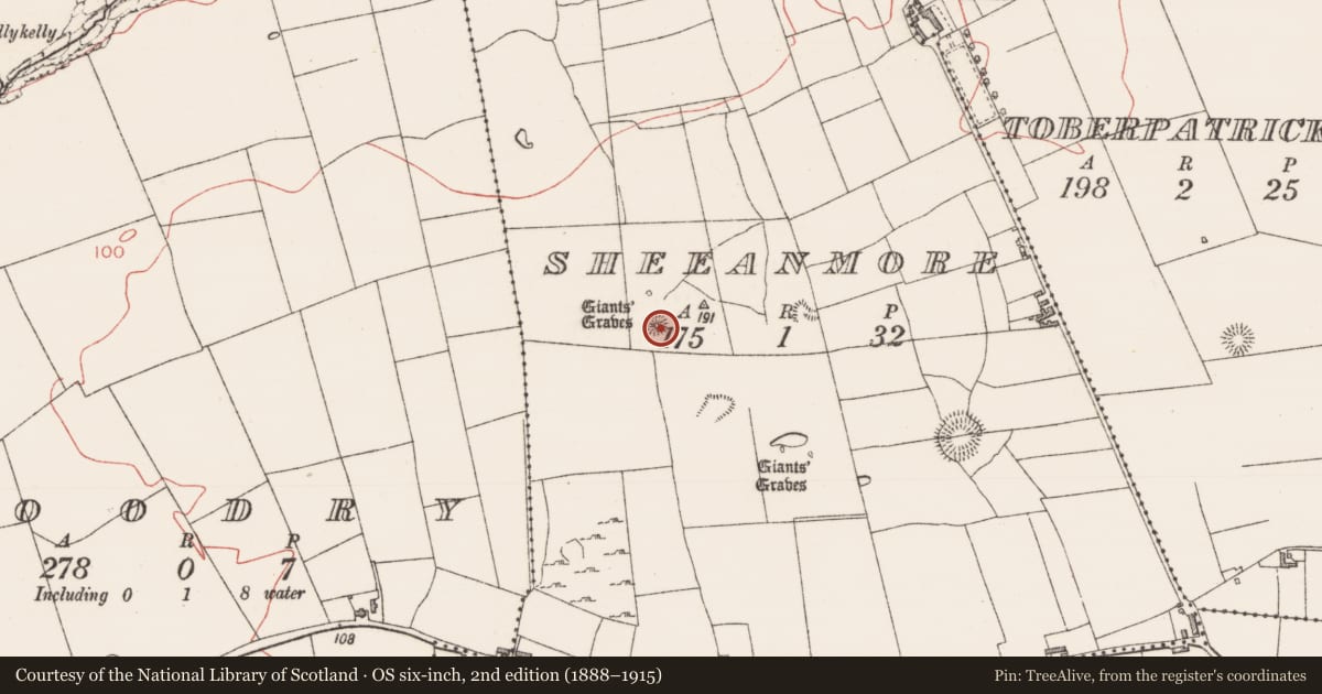
The record
- Townland
- Sheeanmore
- County
- Sligo
- Country
- Ireland
- Coordinates
- 54.26173, -8.70477
- SMR number
- SL013-012003-
Slide toward Today to fade the historical sheet and see the modern map underneath.
David Rumsey Map Collection, Stanford LibrariesDavid Rumsey Map Collection, Stanford LibrariesDavid Rumsey Map Collection, Stanford LibrariesDavid Rumsey Map Collection, Stanford Libraries
4 historical maps cover this location, the earliest the 1790 map "Composite: Ireland." (David Rumsey Map Collection, Stanford Libraries).
Historical maps covering this location
- 1790 · Composite: Ireland. (David Rumsey Map Collection, Stanford Libraries)
- 1869 · Ireland. (David Rumsey Map Collection, Stanford Libraries)
- 1891 · Ireland 16 (David Rumsey Map Collection, Stanford Libraries)
- 1904 · Sheet 4. (David Rumsey Map Collection, Stanford Libraries)
This record in the National Monuments Service's Historic Environment Viewer ↗
The National Monuments Service's description
Situated on lower S facing slopes of Sheeanmore Hill in pasture. Roughly rectangular area (dims 14m E-W; 13m N-S) enclosed by a bank of earth and stone (Wth 2.2m-4m; int. H 0.3m-0.5m; ext. H 0.2m-0.3m). There is no fosse visible at ground level. The internal face of the bank is revetted at E with limestone slabs laid on edge external face of the bank is revetted with similar limestone slabs SE-S-SW. Probable entrance feature is marked by a pair of upright rectangular slabs, standing 0.4m apart, extending perpendicularly from the inner face of the bank at N (W stone-T 0.3m; H 1m; E stone- T 0.2m; H .4m). The interior of the site is strewn with rubble limestone that is concentrated into thirteen low cairns (av. dims. Wth base 2m; H 0.3m) There are also five roughly rectangular quarried limestone blocks (L 0.6m-1m; 0.25m-0.35m square) strewn in no clear order. Site is known locally as an infants' burial ground.
Attached images:
SL013-012002-_01.JPG viewed from E
SL013-012002-_02.JPG viewed from W, with mound barrow (SL013-012002-) in the background
SL013-012002-_02.JPG viewed from N
Compiled by: Mark Keegan
Date of upload: 19 January 2011
Nearby in the register
- Barrow - mound barrowunder 1 mi
- Field systemunder 1 mi
- Cairn - unclassifiedunder 1 mi
- Ringfort - rathunder 1 mi
Other entries of the same register within about three miles of this one, by straight line.