Sites and Monuments Record · Ireland
Leacht
Inishmurray, County Sligo, Ireland
The record
- Townland
- Inishmurray
- County
- Sligo
- Country
- Ireland
- Latest-edition OS map
- Not indicated
- Coordinates
- 54.43114, -8.65230
- SMR number
- SL001-013003-
Slide toward Today to fade the historical sheet and see the modern map underneath.
David Rumsey Map Collection, Stanford LibrariesDavid Rumsey Map Collection, Stanford LibrariesDavid Rumsey Map Collection, Stanford LibrariesDavid Rumsey Map Collection, Stanford Libraries
4 historical maps cover this location, the earliest the 1869 map "Ireland." (David Rumsey Map Collection, Stanford Libraries).
Historical maps covering this location
- 1869 · Ireland. (David Rumsey Map Collection, Stanford Libraries)
- 1891 · Ireland 16 (David Rumsey Map Collection, Stanford Libraries)
- 1904 · Sheet 4. (David Rumsey Map Collection, Stanford Libraries)
- 1922 · Ireland - northern section. (David Rumsey Map Collection, Stanford Libraries)
This record in the National Monuments Service's Historic Environment Viewer ↗
The National Monuments Service's description
Located within a small stone-built enclosure (SL001-013001-).
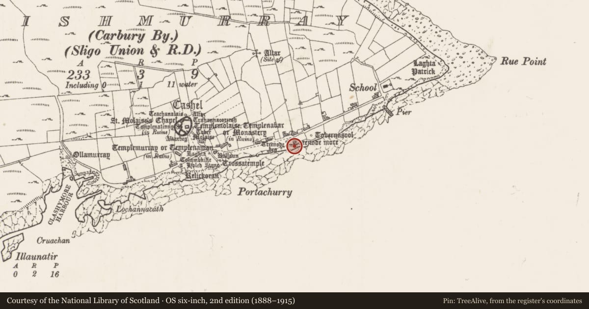
This is a National Monument (no. 117) in state ownership. Traditionally known as Treenode More (Tríonóid Mór or ‘Great Trinity [Leacht]’), this leacht stands centrally within the enclosure and is a well-made rectilinear cairn of evenly course flat stones, brought to a fair finish on all sides and a flat upper surface. It measures 1.53 m east/west by 1.4 m north/south and is 0.8m high. A fine cross-slab (SL001-013002-) surmounts. The leacht is remarkably well preserved, perhaps rebuilt on at least one occasion.
Another leacht (SL001-014001-), known as Treenode Beg, is located outside the enclosure, a few meters to W.
The above description is derived from the results of a survey of the archaeological monuments on Inishmurray undertaken in 1997-1999, and published in:
Jerry O’Sullivan and Tomás Ó Carragáin 2008 Inishmurrary. Monks and pilgrims in an Atlantic landscape. Volume 1: Archaeological Survey and Excavations 1997-2000. Cork. The Collins Press.
Date of upload: 19 February 2018
Nearby in the register
- Enclosureunder 1 mi
- Cross-inscribed pillarunder 1 mi
- Leachtunder 1 mi
- Ritual site - holy wellunder 1 mi
Other entries of the same register within about three miles of this one, by straight line.