Sites and Monuments Record · Ireland
Enclosure
Inishmurray, County Sligo, Ireland
The record
- Townland
- Inishmurray
- County
- Sligo
- Country
- Ireland
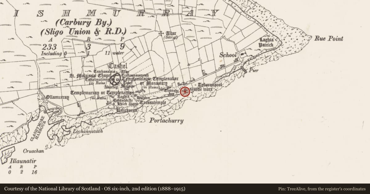
- Latest-edition OS map
- Treenode More
- Coordinates
- 54.43114, -8.65230
- SMR number
- SL001-013001-
Slide toward Today to fade the historical sheet and see the modern map underneath.
David Rumsey Map Collection, Stanford LibrariesDavid Rumsey Map Collection, Stanford LibrariesDavid Rumsey Map Collection, Stanford LibrariesDavid Rumsey Map Collection, Stanford Libraries
4 historical maps cover this location, the earliest the 1869 map "Ireland." (David Rumsey Map Collection, Stanford Libraries).
Historical maps covering this location
- 1869 · Ireland. (David Rumsey Map Collection, Stanford Libraries)
- 1891 · Ireland 16 (David Rumsey Map Collection, Stanford Libraries)
- 1904 · Sheet 4. (David Rumsey Map Collection, Stanford Libraries)
- 1922 · Ireland - northern section. (David Rumsey Map Collection, Stanford Libraries)
This record in the National Monuments Service's Historic Environment Viewer ↗
The National Monuments Service's description
Located 270m to SE of an ecclesiastical enclosure/cashel (SL001-001001-), over cliffs.
This is a National Monument (no. 117) in state ownership. Drystone rubble walls form an enclosure which measures 4.5 m east/west by 3.5 m north/south within walls up to 1 m thick and 1.4 m high on the south or seaward slope, but 0.8 m high elsewhere. The walls include frequent small flat slabs and are roughly coursed to produce a sound build with a fair-faced finish. There is a narrow entrance on the west side (facing Treenode Beg leacht (SL001-014001-) 0.7 m wide; this is spanned by an edge-set sill at the inner wall face.
There is a leacht (SL001-013003-), known as Treenode More, and cross slab (SL001-013002-) within this enclosure. Another leacht (SL001-014001-) is located outside the enclosure, a few meters to W.
The above description is derived from the results of a survey of the archaeological monuments on Inishmurray undertaken in 1997-1999 and published in:
Jerry O’Sullivan and Tomás Ó Carragáin 2008 Inishmurrary. Monks and pilgrims in an Atlantic landscape. Volume 1: Archaeological Survey and Excavations 1997-2000. Cork. The Collins Press.
Date of upload: 19 February 2018
Nearby in the register
- Cross-inscribed pillarunder 1 mi
- Leachtunder 1 mi
- Leachtunder 1 mi
- Ritual site - holy wellunder 1 mi
Other entries of the same register within about three miles of this one, by straight line.