Sites and Monuments Record · Ireland
Ringfort - rath
Carrowmore (Gallen By., Bohola Par.), County Mayo, Ireland
The record
- Townland
- Carrowmore (Gallen By., Bohola Par.)
- County
- Mayo
- Country
- Ireland
- First-edition OS map
- Indicated
- Latest-edition OS map
- Hachured
- Coordinates
- 53.89675, -9.00747
- SMR number
- MA071-134----
Slide toward Today to fade the historical sheet and see the modern map underneath.
David Rumsey Map Collection, Stanford LibrariesDavid Rumsey Map Collection, Stanford LibrariesDavid Rumsey Map Collection, Stanford LibrariesDavid Rumsey Map Collection, Stanford Libraries
4 historical maps cover this location, the earliest the 1753 map "Mappa geographica Regni Hiberniae" (David Rumsey Map Collection, Stanford Libraries).
Historical maps covering this location
- 1753 · Mappa geographica Regni Hiberniae (David Rumsey Map Collection, Stanford Libraries)
- 1790 · Composite: Ireland. (David Rumsey Map Collection, Stanford Libraries)
- 1869 · Ireland. (David Rumsey Map Collection, Stanford Libraries)
- 1891 · Ireland 16 (David Rumsey Map Collection, Stanford Libraries)
This record in the National Monuments Service's Historic Environment Viewer ↗
The National Monuments Service's description
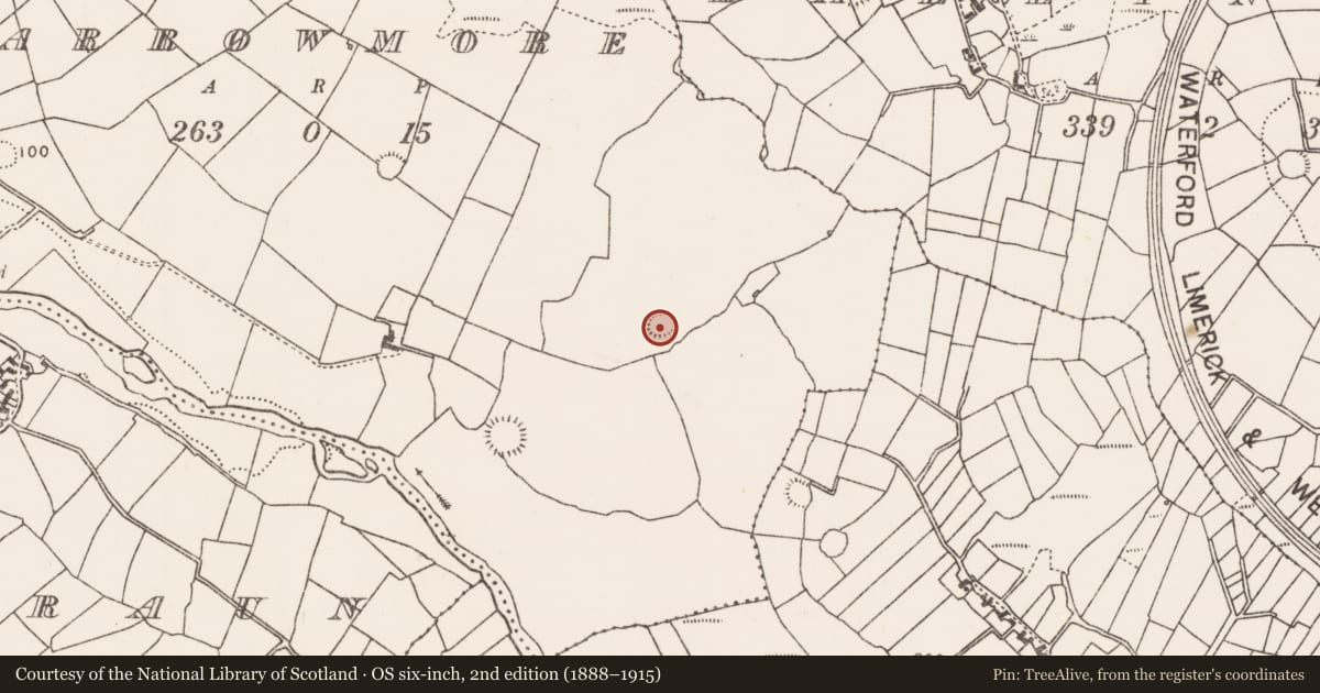
In pasture, on a ridge top, just below the summit, at the break of slope on the S side. At the base of the slope at SW there small valley of wet ground with another ridge beyond that on which a rath (MA071-133----) is visible 200m to SW. There are good views to N−E along a small river valley, with the river located 200m to N. Two other raths (MA071-135----; MA071-136----) are located c. 240m to SE.
Broadly oval raised area (26m N−S; 29.7m E−W) defined by an earthen bank (Wth 3.1m; int. H 0.7m; ext. H 1.4m), which is reduced to a scarp (H 2.2m) at SE−W. A few stones protrude randomly from the scarp. On the SW the scarp has been adapted to serve as a field boundary. The interior is level, except for a slight slope down to S in the S third. Traces of cultivation ridges on a roughly E-W axis traverse the interior. Grass cover, with a few hawthorn trees around the perimeter.
Compiled by: Jane O’Shaughnessy
Date of upload: 10 September 2021
Nearby in the register
- Ringfort - rathunder 1 mi
- Ringfort - rathunder 1 mi
- Ringfort - rathunder 1 mi
- Ringfort - rathunder 1 mi
Other entries of the same register within about three miles of this one, by straight line.