Sites and Monuments Record · Ireland
Ringfort - rath
Barroe (Costello By.), County Mayo, Ireland
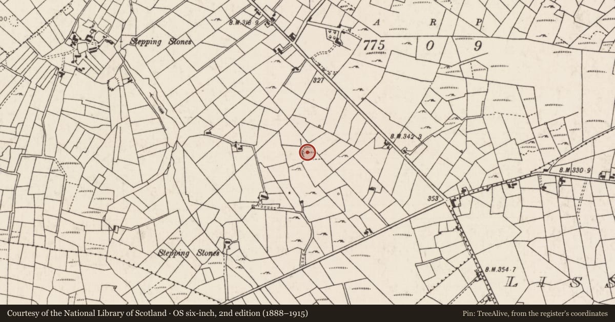
The record
- Townland
- Barroe (Costello By.)
- County
- Mayo
- Country
- Ireland
- First-edition OS map
- Indicated
- Latest-edition OS map
- Hachured
- Coordinates
- 53.96055, -8.71029
- SMR number
- MA063-016----
Slide toward Today to fade the historical sheet and see the modern map underneath.
David Rumsey Map Collection, Stanford LibrariesDavid Rumsey Map Collection, Stanford LibrariesDavid Rumsey Map Collection, Stanford LibrariesDavid Rumsey Map Collection, Stanford Libraries
4 historical maps cover this location, the earliest the 1790 map "Composite: Ireland." (David Rumsey Map Collection, Stanford Libraries).
Historical maps covering this location
- 1790 · Composite: Ireland. (David Rumsey Map Collection, Stanford Libraries)
- 1811 · Ireland. (David Rumsey Map Collection, Stanford Libraries)
- 1869 · Ireland. (David Rumsey Map Collection, Stanford Libraries)
- 1891 · Ireland 16 (David Rumsey Map Collection, Stanford Libraries)
This record in the National Monuments Service's Historic Environment Viewer ↗
The National Monuments Service's description
In rough pasture, broken by rock outcropping. Views good but not extensive, best to NW.
Slightly raised, roughly circular area (29m N–S; c. 28m E–W) defined by remnants of a stone bank, incorporated into or truncated by later field walls.
At SW–N the stone bank is evidentt as a low, slumped sod-covered stony rise/scarp (Wth c. 3m; ext. H 0.6m). At NE–E it is overlain or truncated by a later linear field wall on a NW–SE axis. At SE a slight stony rise (Wth 1.4-2m; H 0.3-0.5m) is evident; at S–SW it is incorporated into a later wall (Wth 0.7m; H 1m), which respects its curve. The location of the original entrance is not obvious. The interior level and grassy; there are relict cultivation ridges on a N−S axis. In the N half, there is a sod-covered heap (c. 4m across; H c. 0.5m) of stones, most likely a field clearance heap. The perimeter at SE-NE is thickly ringed with hazel, hawthorn, blackthorn and brambles.
Compiled by: Jane O'Shaughnessy
Date of upload: 7 July 2020
Nearby in the register
- Ringfort - unclassifiedunder 1 mi
- Children's burial groundunder 1 mi
- Souterrainunder 1 mi
- Ringfort - rathunder 1 mi
Other entries of the same register within about three miles of this one, by straight line.