Sites and Monuments Record · Ireland
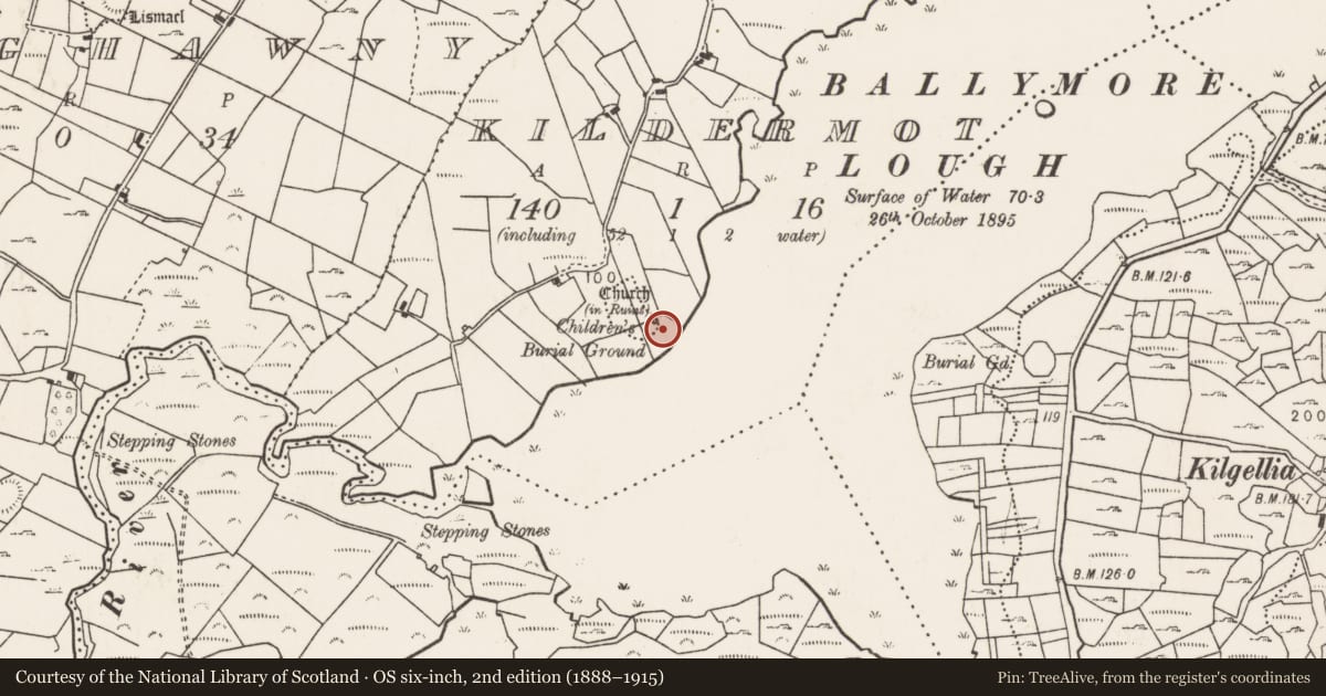
Children's burial ground
Kildermot, County Mayo, Ireland
The record
- Townland
- Kildermot
- County
- Mayo
- Country
- Ireland
- First-edition OS map
- Not indicated
- Latest-edition OS map
- Childrens Burial Ground
- Coordinates
- 54.05832, -9.09010
- SMR number
- MA040-074002-
Slide toward Today to fade the historical sheet and see the modern map underneath.
David Rumsey Map Collection, Stanford LibrariesDavid Rumsey Map Collection, Stanford LibrariesDavid Rumsey Map Collection, Stanford LibrariesDavid Rumsey Map Collection, Stanford Libraries
4 historical maps cover this location, the earliest the 1790 map "Composite: Ireland." (David Rumsey Map Collection, Stanford Libraries).
Historical maps covering this location
- 1790 · Composite: Ireland. (David Rumsey Map Collection, Stanford Libraries)
- 1841 · Ireland. (David Rumsey Map Collection, Stanford Libraries)
- 1869 · Ireland. (David Rumsey Map Collection, Stanford Libraries)
- 1891 · Ireland 16 (David Rumsey Map Collection, Stanford Libraries)
This record in the National Monuments Service's Historic Environment Viewer ↗
The National Monuments Service's description
Located adjacent to a Kildermot church (MA040-074001-), on a narrow ridge top overlooking Balymore Lake.
A strip of relatively level ground on the ridge top wraps around the E, S and SW side of the church forming an irregular-shaped terrace from the edge of which there is a steep drop to the lake shore. This terrace has been used as a children’s burial ground, indicated on the 1838 and 1929 OS 6-inch maps. The SE−S edge of the terrace is defined by a scarp (H 2m) merging with the steep ridge slope, and at SW−W by a low sod-covered stony scarp (H c. 0.5m). The church borders the NW side of the burial area and field fences define its limits at NE and W. The enclosed grass-grown space (c. 30m NE−SW; c. 15m NW−SE at E end, 5.4m NW−SE at SW end) is dotted with numerous, low upright uninscribed stone grave-markers, most of which barely protrude above the ground surface.
Attached images:
MA040-074002-_01.JPG viewed from SW
MA040-074002-_02.JPG viewed from S
MA040-074002-_03.JPG viewed from N
Compiled by: Jane O’Shaughnessy
Date of upload: 5 June 2020
Nearby in the register
- Bullaun stoneunder 1 mi
- Architectural fragmentunder 1 mi
- Churchunder 1 mi
- Crannogunder 1 mi
Other entries of the same register within about three miles of this one, by straight line.