Sites and Monuments Record · Ireland
Mound
Inis Gé Thuaidh, County Mayo, Ireland
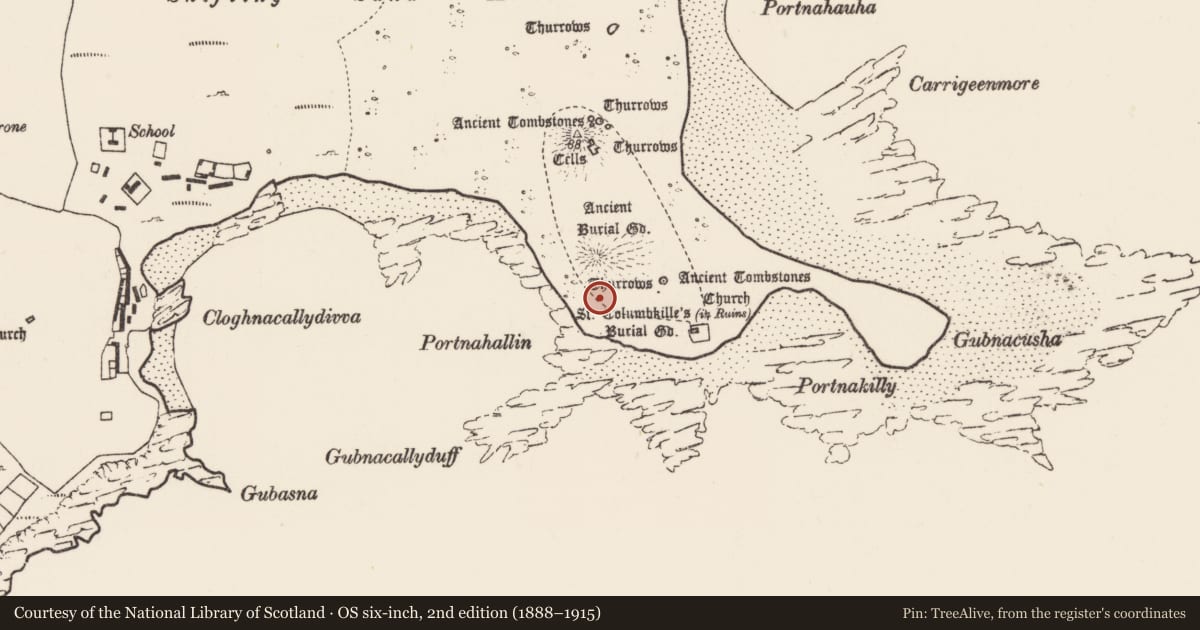
The record
- Townland
- Inis Gé Thuaidh
- County
- Mayo
- Country
- Ireland
- First-edition OS map
- Not indicated
- Latest-edition OS map
- Not indicated
- Coordinates
- 54.12995, -10.18806
- SMR number
- MA023-014031-
Slide toward Today to fade the historical sheet and see the modern map underneath.
David Rumsey Map Collection, Stanford LibrariesDavid Rumsey Map Collection, Stanford LibrariesDavid Rumsey Map Collection, Stanford LibrariesDavid Rumsey Map Collection, Stanford Libraries
4 historical maps cover this location, the earliest the 1790 map "Composite: Ireland." (David Rumsey Map Collection, Stanford Libraries).
Historical maps covering this location
- 1790 · Composite: Ireland. (David Rumsey Map Collection, Stanford Libraries)
- 1841 · Ireland. (David Rumsey Map Collection, Stanford Libraries)
- 1869 · Ireland. (David Rumsey Map Collection, Stanford Libraries)
- 1891 · Ireland 16 (David Rumsey Map Collection, Stanford Libraries)
This record in the National Monuments Service's Historic Environment Viewer ↗
The National Monuments Service's description
On a machair plain on the SE side of Inishkea North, 20m N of the rocky shoreline and 150m S of a larger mound known as Bailey Mór (MA023-014003-). There is an ecclesiastical site (MA023-014033001-) c. 50m to NE and a graveyard (MA023-0140012-) 100m to SE.
Known in local tradition as ‘Bailey Beag’, it consists of a conical steep-sided mound (diam. c. 23m; H 3.8m), which appears at its core to be a sand hill. The 1838 and 1920 OS 6-inch maps depict it as larger in diameter than the surviving remains, suggesting that erosion has greatly diminished it.
The grass-covered slopes have a rough cladding of large stones and slabs (some up to 1m in max. dim.) and the narrow summit is crowned with a small, low cairn of stones (c. 3m N-S; c. 3m E-W; H 0.6-0.7m). Most of the stones on the summit appear loose but a few are set upright, possibly part of a structure, perhaps remnants of the house (MA023-014032-) which Henry (1945, 140; House I) noted here in the late 1930’s. A thin scatter of seashells, likely to be occupation debris, is visible on the top and slopes of the mound where grass cover has eroded. It is a National Monument in state ownership (no. 379).
Attached images:
MA023-014031-_01.JPG Viewed from S with Bailey Mór mound (MA023-014003-) in background
MA023-014031-_02.JPG Viewed from SW
Compiled by: Jane O’Shaughnessy
Date of upload: 27 July 2023
References
Henry, F. 1945 Remains of the Early Christian Period on Inishkea North, Co. Mayo. Journal of the Royal Society of Antiquaries of Ireland 75, 127-55.
Nearby in the register
- House - medievalunder 1 mi
- Cross-slabunder 1 mi
- Platformunder 1 mi
- Enclosureunder 1 mi
Other entries of the same register within about three miles of this one, by straight line.