Sites and Monuments Record · Ireland
Cross-slab
Inis Gé Thuaidh, County Mayo, Ireland
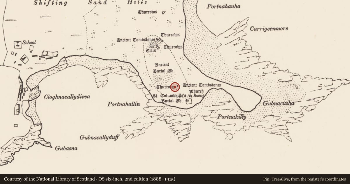
The record
- Townland
- Inis Gé Thuaidh
- County
- Mayo
- Country
- Ireland
- First-edition OS map
- Not indicated
- Latest-edition OS map
- Not indicated
- Coordinates
- 54.13012, -10.18694
- SMR number
- MA023-014035-
Slide toward Today to fade the historical sheet and see the modern map underneath.
David Rumsey Map Collection, Stanford LibrariesDavid Rumsey Map Collection, Stanford LibrariesDavid Rumsey Map Collection, Stanford LibrariesDavid Rumsey Map Collection, Stanford Libraries
4 historical maps cover this location, the earliest the 1790 map "Composite: Ireland." (David Rumsey Map Collection, Stanford Libraries).
Historical maps covering this location
- 1790 · Composite: Ireland. (David Rumsey Map Collection, Stanford Libraries)
- 1841 · Ireland. (David Rumsey Map Collection, Stanford Libraries)
- 1869 · Ireland. (David Rumsey Map Collection, Stanford Libraries)
- 1891 · Ireland 16 (David Rumsey Map Collection, Stanford Libraries)
This record in the National Monuments Service's Historic Environment Viewer ↗
The National Monuments Service's description
This cross-slab is one of two cross-slabs associated with a large circular platform (MA023-014033-). It originally stood at roughly this location towards the S edge of a large circular platform (MA023-014033-) on the SE side of Inishkea North. It is now in the National Museum of Ireland. The other cross-slab (MA023-014034-) remains in situ on the E perimeter of the platform.
This cross slab was excavated by Henry (1945, 141-143; Slab 4) who found it roughly in the centre of the S half of the platform, ‘three quarters buried in the sand’, with only part of the decorated W face visible. Excavation revealed that the cross-slab was enclosed on its E side by a semi-circular wall/bank of loose stones and black earth, and a layer of burnt clay, ashes and shells lay at the base of the cross, within the arc of the wall.
The slab is subrectangular in shape with a gently rounded top. The incised design fills almost the full available space on one broad face (originally W-facing) of the stone. It consists of a cross of arcs in a double circle. The circle rests on a symmetrical back-to-back arrangement of paired spirals flanked by two small Maltese crosses each in a circle. Traces of a plait-like motif fill the narrow space intervening between the upper arc of the circle and the top edge of the stone. The cross-slab is a National Monument in state ownership (no. 379).
Attached image:
MA023-014035-_01.JPG Cross-slab in the National Museum
Compiled by: Jane O’Shaughnessy
Date of upload: 28 July 2023
Nearby in the register
- Platformunder 1 mi
- Cross-slabunder 1 mi
- House - medievalunder 1 mi
- Moundunder 1 mi
Other entries of the same register within about three miles of this one, by straight line.