Sites and Monuments Record · Ireland
Bawn
Ashfort, County Limerick, Ireland
The record
- Townland
- Ashfort
- County
- Limerick
- Country
- Ireland
- First-edition OS map
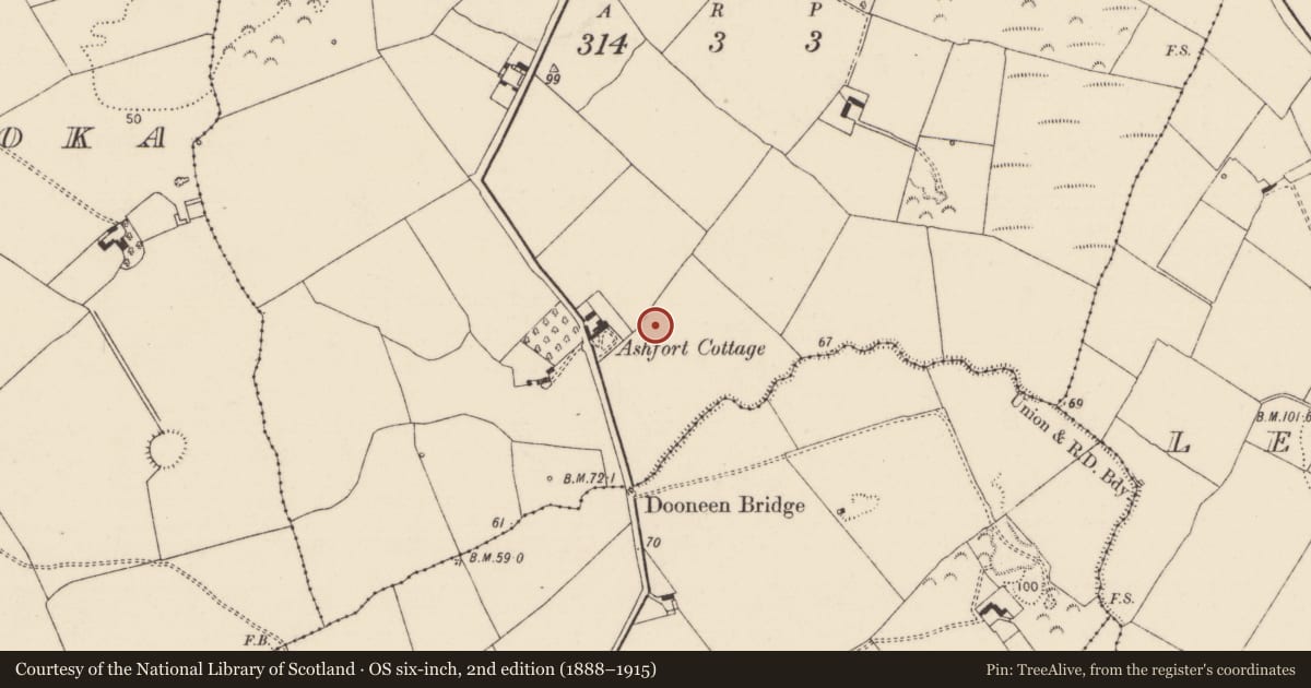
- Castle Field
- Latest-edition OS map
- Not indicated
- Coordinates
- 52.60037, -8.66993
- SMR number
- LI013-077001-
Slide toward Today to fade the historical sheet and see the modern map underneath.
David Rumsey Map Collection, Stanford LibrariesDavid Rumsey Map Collection, Stanford LibrariesDavid Rumsey Map Collection, Stanford LibrariesDavid Rumsey Map Collection, Stanford Libraries
4 historical maps cover this location, the earliest the 1790 map "Composite: Ireland." (David Rumsey Map Collection, Stanford Libraries).
Historical maps covering this location
- 1790 · Composite: Ireland. (David Rumsey Map Collection, Stanford Libraries)
- 1869 · Ireland. (David Rumsey Map Collection, Stanford Libraries)
- 1891 · Ireland 16 (David Rumsey Map Collection, Stanford Libraries)
- 1904 · Sheet 13. (David Rumsey Map Collection, Stanford Libraries)
This record in the National Monuments Service's Historic Environment Viewer ↗
The National Monuments Service's description
Earthworks in field visible on OSi orthoimage taken 2005-12 which is annotated 'Castle Field' on 1840 ed. OSi 6-inch map may represent the remains of the castle (LI013-077----) and bawn of Annaghrostie. It is possible that the orchard to the N of Ashfort Cottage located 90m to WNW may be an alternative site for castle bawn. Westropp (1906-07, 154) recorded the following details about Ashfort or Annaghrostie Castle; ' "Castle Field" marked. 1542 Anaroche held by Tege O'Brene (Carew, i., p. 202) and by Brian Duff, 1584 (Fi. 4486, 4615). 1600 N. Stritch held a moiety of the C[astle]. and surrounding wall or bawn of Annagh Rosin (Inq. Exch., 50, 54; Chan. 10a). 1609 The ford of Anagh Irestie and brook at Anagh Irestie (Perambulation Deed). 1657 It was then in Mungret, and lay near the stream opposite Greenmount (C.S., p. 11; Petty Map, 64; D.S.A., 1). 1667 Confirmed to E. Rolleston'.
Compiled by: Caimin O'Brien
Date of upload: 26 November 2020
References
Westropp, T.J. 1906-7 The ancient castles of the county of Limerick. Proceedings of the Royal Irish Academy 26, 54-264.
Nearby in the register
- Castle - unclassifiedunder 1 mi
- Ringfort - rathunder 1 mi
- Enclosureunder 1 mi
- Ringfort - rathunder 1 mi
Other entries of the same register within about three miles of this one, by straight line.