Sites and Monuments Record · Ireland
Cairn - burial cairn
Gannavane, County Limerick, Ireland
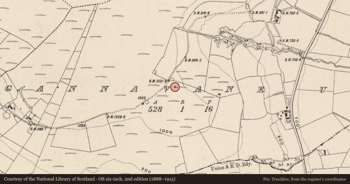
The record
- Townland
- Gannavane
- County
- Limerick
- Country
- Ireland
- First-edition OS map
- Not indicated
- Latest-edition OS map
- Not indicated
- Coordinates
- 52.66341, -8.25092
- SMR number
- LI008-010----
Slide toward Today to fade the historical sheet and see the modern map underneath.
David Rumsey Map Collection, Stanford LibrariesDavid Rumsey Map Collection, Stanford LibrariesDavid Rumsey Map Collection, Stanford LibrariesDavid Rumsey Map Collection, Stanford Libraries
4 historical maps cover this location, the earliest the 1790 map "Composite: Ireland." (David Rumsey Map Collection, Stanford Libraries).
Historical maps covering this location
- 1790 · Composite: Ireland. (David Rumsey Map Collection, Stanford Libraries)
- 1869 · Ireland. (David Rumsey Map Collection, Stanford Libraries)
- 1891 · Ireland 16 (David Rumsey Map Collection, Stanford Libraries)
- 1904 · Sheet 13. (David Rumsey Map Collection, Stanford Libraries)
This record in the National Monuments Service's Historic Environment Viewer ↗
The National Monuments Service's description
Situated on a ridge of poorly drained land in upland area on the SE facing slope of Cullaun Mountain with commanding views of the surrounding countryside from NE-E-S-W. The summit of Cullaun Mountain with ring-barrow (LI008-003----) rises high above the monument 800m to NW. Low orthostats (H 0.3m) protruding above the surface of the heather-covered ground represents the the remains of a cist (L 3m x Wth 1m) roughly aligned N-S which was covered by a low stone cairn (approx. ext. diam. 8.8m) the revetment of which is visible as low upright stones forming a roughly circular shaped outline which is clearly visible on Digital Globe orthoimage taken 2011-13. Two prostrate stone slabs lying on the surface of the ground to the N of the upright orthostats appear to be the remains of displaced capstones. Could be the robbed-out remains of burial cairn with central cist, the presence of loose stones lying around the perimeter of the monument may be the remains of the original cairn material.
Compiled by: Caimin O’Brien based on information provided by John Carey
Date of upload: 24 September 2020
Nearby in the register
- Barrow - unclassifiedunder 1 mi
- Barrow - pond barrowunder 1 mi
- Barrow - ring-barrowunder 1 mi
- Ringfort - rathunder 1 mi
Other entries of the same register within about three miles of this one, by straight line.