Sites and Monuments Record · Ireland
Graveslab
Callan South, County Kilkenny, Ireland
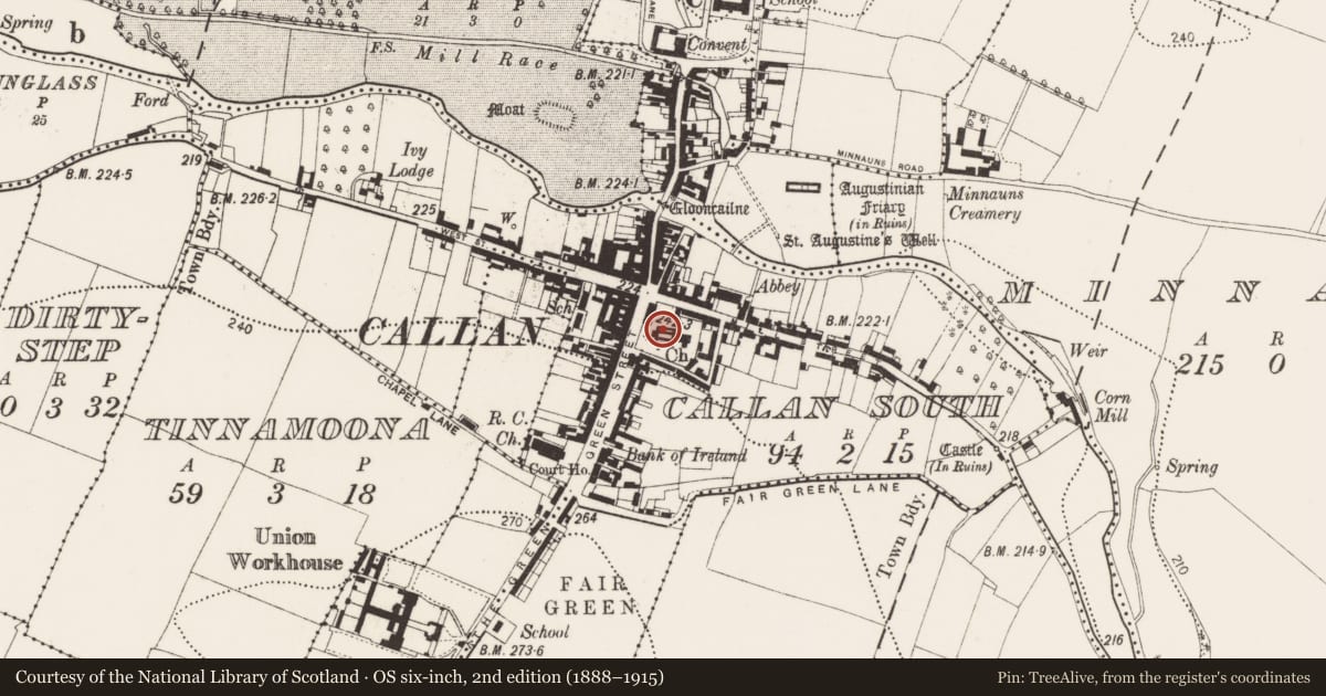
The record
- Townland
- Callan South
- County
- Kilkenny
- Country
- Ireland
- First-edition OS map
- Not indicated
- Latest-edition OS map
- Not indicated
- Coordinates
- 52.54406, -7.38980
- SMR number
- KK026-010047-
Slide toward Today to fade the historical sheet and see the modern map underneath.
David Rumsey Map Collection, Stanford LibrariesDavid Rumsey Map Collection, Stanford LibrariesDavid Rumsey Map Collection, Stanford LibrariesDavid Rumsey Map Collection, Stanford Libraries
4 historical maps cover this location, the earliest the 1790 map "Composite: Ireland." (David Rumsey Map Collection, Stanford Libraries).
Historical maps covering this location
- 1790 · Composite: Ireland. (David Rumsey Map Collection, Stanford Libraries)
- 1869 · Ireland. (David Rumsey Map Collection, Stanford Libraries)
- 1882 · Ireland (southern half). (David Rumsey Map Collection, Stanford Libraries)
- 1891 · Ireland 16 (David Rumsey Map Collection, Stanford Libraries)
This record in the National Monuments Service's Historic Environment Viewer ↗
The National Monuments Service's description
Lying prostrate in the centre of the nave of St Mary’s church (KK026-010012-), Callan. The upper portion of a limestone slab (total L 1.76m; Wth 0.97m; min. T 0.11m). It is decorated with a banded cross with a seven-armed segmented cross-head with fleur-de-lys terminals, carved in relief. There is a three-barred knop below the cross-head and above the band. Beneath the truncated dexter band there is a heraldic shield bearing the Whyte coat of arms, described by Carrigan (1905, vol. 3, 301) as, ‘a chevron engrailed, between three mullets’. There is an inscription around the border (Wth 012m) in latin, in raised Black Letter script which has been transcribed by Carrigan (ibid. 300) as, ‘Hic jacet discretus vir Nicol….Whyt qu……..D M CCCCCC xli q cui aia oib Pr & ave dicetibus clx dies indulget concedut’ and translated as, ‘Here lies the discreet man Nicholas Whyt formerly…… 1541. An indulgence of 160 days is granted to all who pray for his soul’. The slab is broken vertically from the top, through the cross-head and sinister band.
Compiled by: Jean Farrelly
Date of upload: 13 November 2019
References
Carrigan, Rev. W. 1905 (Reprint 1981) The history and antiquities of the diocese of Ossory, 4 vols. Kilkenny. Roberts Books and Wellbrook Press.
Nearby in the register
- Graveslabunder 1 mi
- Tomb - chest tombunder 1 mi
- Graveslabunder 1 mi
- Graveslabunder 1 mi
Other entries of the same register within about three miles of this one, by straight line.