Sites and Monuments Record · Ireland
Excavation - miscellaneous
Gardens (Kilkenny City By., St. Mary’s Par.), County Kilkenny, Ireland
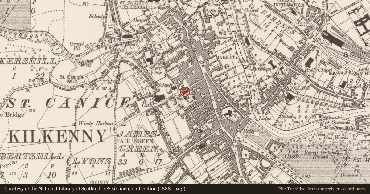
The record
- Townland
- Gardens (Kilkenny City By., St. Mary’s Par.)
- County
- Kilkenny
- Country
- Ireland
- First-edition OS map
- Not indicated
- Latest-edition OS map
- Not indicated
- Coordinates
- 52.65270, -7.25528
- SMR number
- KK019-026149-
Slide toward Today to fade the historical sheet and see the modern map underneath.
David Rumsey Map Collection, Stanford LibrariesUniversity Library, Vrije Universiteit AmsterdamDavid Rumsey Map Collection, Stanford LibrariesDavid Rumsey Map Collection, Stanford Libraries
4 historical maps cover this location, the earliest the 1790 map "Composite: Ireland." (David Rumsey Map Collection, Stanford Libraries).
Historical maps covering this location
- 1790 · Composite: Ireland. (David Rumsey Map Collection, Stanford Libraries)
- 1869 · Ireland. (David Rumsey Map Collection, Stanford Libraries)
- 1891 · Ireland 16 (David Rumsey Map Collection, Stanford Libraries)
- 1911 · Sheet 14, 1911 (University Library, Vrije Universiteit Amsterdam)
This record in the National Monuments Service's Historic Environment Viewer ↗
The National Monuments Service's description
An archaeological excavation (92E0038) was carried out by John Channing in 1992 within plot that stretched from High Street to the western stretch of the town wall of the Hightown of Kilkenny (Channing 1992, unpublished; 1993). The plot is shown as wholly occupied by buildings extending N-S from Red Lane to James Street and E-W from High Street to the town wall on John Rocque's 1758 map of Kilkenny. The site was occupied by the Presentation convent school and chapel, James's Street from 1800 until 1992, at which time it was demolished for construction of the present Market Cross Shopping Centre (Bradley 2000, 14).
Stone-lined and unlined pits containing medieval pottery were excavated adjacent to James's Street. One of the pits contained cess-like material. Also uncovered were two wells (KK019-026082-; KK019-026095-), portions of which were preserved in situ below the formation level of the present shopping centre.
Compiled by: Cóilín Ó Drisceoil
Date of upload: 28 March 2022
References
Bradley, J. 2000 Kilkenny. Irish Historic Towns Atlas no. 10. Dublin. Royal Irish Academy.
Channing, J. 1993 'Presentation Convent and old brewery site', James St., Kilkenny: medieval. In I. Bennett (ed.), Excavations 1992: summary accounts of archaeological excavations in Ireland, 39, no. 114. Bray. Wordwell.
Channing, J. 1992, Report on archaeological watching brief at Presentation Convent and Old Brewery sites, Kilkenny. Unpublished report.
Nearby in the register
Other entries of the same register within about three miles of this one, by straight line.