Sites and Monuments Record · Ireland
Well
Gardens (Kilkenny City By., St. Mary’s Par.), County Kilkenny, Ireland
The record
- Townland
- Gardens (Kilkenny City By., St. Mary’s Par.)
- County
- Kilkenny
- Country
- Ireland
- First-edition OS map
- Not indicated
- Latest-edition OS map
- Not indicated
- Coordinates
- 52.65279, -7.25567
- SMR number
- KK019-026194-
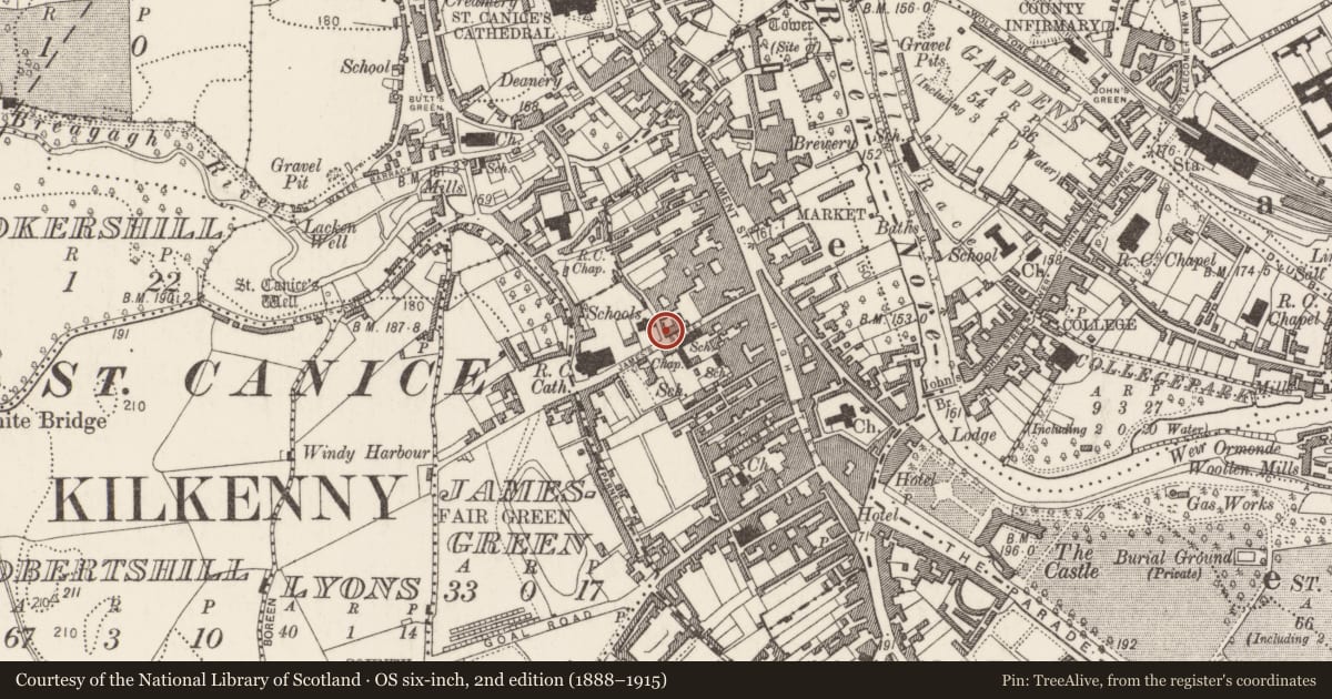
Slide toward Today to fade the historical sheet and see the modern map underneath.
David Rumsey Map Collection, Stanford LibrariesUniversity Library, Vrije Universiteit AmsterdamDavid Rumsey Map Collection, Stanford LibrariesDavid Rumsey Map Collection, Stanford Libraries
4 historical maps cover this location, the earliest the 1790 map "Composite: Ireland." (David Rumsey Map Collection, Stanford Libraries).
Historical maps covering this location
- 1790 · Composite: Ireland. (David Rumsey Map Collection, Stanford Libraries)
- 1869 · Ireland. (David Rumsey Map Collection, Stanford Libraries)
- 1891 · Ireland 16 (David Rumsey Map Collection, Stanford Libraries)
- 1911 · Sheet 14, 1911 (University Library, Vrije Universiteit Amsterdam)
This record in the National Monuments Service's Historic Environment Viewer ↗
The National Monuments Service's description
No. 23 James Street is on the corner of James’s Street and Tilbury Place 20m NW of St James's Gate on the town wall (KK019-026001-) of the Hightown of Kilkenny (Farrelly et al 1993, 11; Munby and Tyler (Oxford Archaeology) 2003, 82-3). The plot is fronted by a three-storey Edwardian house (NIAH 12000035) with modern extensions to the rear. Two archaeological excavations have been carried out on the plot. As well as medieval pits and deposits (KK 019-026191-), a burial (KK 019-026199-) and a smelting furnace (KK 019-026196-), test excavations by Paul Stevens (00E0730) identified a circular well (diam. 1.06m) lined with mortared cobbles (Stevens 2000, unpublished report; 2002, 177-8; 2006, 52-4). The feature was excavated to a depth of 0.65m and its fills produced Kilkenny-type medieval pottery.
Compiled by: Cóilín Ó Drisceoil
Date of upload: 3 November 2020
References
Farrelly, J., O'Reilly, B., and Loughran, A. 1993 Urban archaeological survey - county Kilkenny (2 vols.). Unpublished report commissioned by the Office of Public Works, Dublin.
Stevens, P. 2002 23 James's Street, Kilkenny 00E0730, in I. Bennett (ed.) Excavations 2000: summary accounts of archaeological excavations in Ireland, no. 537, 177-8. Bray. Wordwell.
Munby, J. and Tyler, R. (Oxford Archaeology) 2003 Kilkenny City walls: conservation plan. Kilkenny. Heritage Council.
Stevens, P. 2000 Inspection and Archaeological Impact Assessment 23 James Street, Kilkenny City, Excavation Licence No. 00E0730 (unpublished report.
Stevens, P 2006 Four Excavations in Kilkenny City (1999-2001): Part 1 The Medieval Findings. Old Kilkenny Review 58, 47-66.
Nearby in the register
- Furnaceunder 1 mi
- Burialunder 1 mi
- Excavation - miscellaneousunder 1 mi
- Wellunder 1 mi
Other entries of the same register within about three miles of this one, by straight line.