Sites and Monuments Record · Ireland
Graveslab
Freshford Lots, County Kilkenny, Ireland
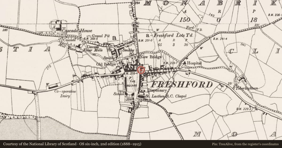
The record
- Townland
- Freshford Lots
- County
- Kilkenny
- Country
- Ireland
- First-edition OS map
- Not indicated
- Latest-edition OS map
- Not indicated
- Coordinates
- 52.73263, -7.39799
- SMR number
- KK013-023010-
Slide toward Today to fade the historical sheet and see the modern map underneath.
David Rumsey Map Collection, Stanford LibrariesDavid Rumsey Map Collection, Stanford LibrariesDavid Rumsey Map Collection, Stanford LibrariesDavid Rumsey Map Collection, Stanford Libraries
4 historical maps cover this location, the earliest the 1790 map "Composite: Ireland." (David Rumsey Map Collection, Stanford Libraries).
Historical maps covering this location
- 1790 · Composite: Ireland. (David Rumsey Map Collection, Stanford Libraries)
- 1811 · Ireland. (David Rumsey Map Collection, Stanford Libraries)
- 1869 · Ireland. (David Rumsey Map Collection, Stanford Libraries)
- 1891 · Ireland 16 (David Rumsey Map Collection, Stanford Libraries)
This record in the National Monuments Service's Historic Environment Viewer ↗
The National Monuments Service's description
Inserted in the inner face of the wall on the W side of the C of I graveyard (KK013-023005-), 2.5m N of the entrance to the graveyard.
The upper portion of a limestone graveslab (Wth 0.8m; H 0.84m) decorated in false relief with a seven-armed cross-head extending from a raised circle. The arms have fleur-de-lis terminals and only the shafts of the three main arms of the cross continue within the circle. A border (Wth 0.12-0.125m), defined by a plain margin along its top and bottom edge, runs along the dexter and sinister side and along the top. Within it, in Roman capitals, in Latin, beginning mid-way along the dexter side and running up to and along the top and down the sinister side, is an inscription in false relief. The fleur-de-lis from the three main arms extend into the border.
The graveslab was in the same location when described by Carrigan (1905, vol. 2, 255) as, 'a fragment of a floor-slab or table of an altar tomb, built into the graveyard wall, beside the entrance gate, has the following around the edge, in raised Old English letters: Hic jacet Edith uxor Johais Patridge qui obit die Sepbris….'. The inscription, in Black Letter script, translates as, Here lies Edith wife of John Partridge who died on the … day of September...’. The slab is dated by Cockerham and Harris (2001, 187) to c. 1600.
Compiled by: Jean Farrelly
Date of upload: 22 August 2022
References
Carrigan, Rev. W. 1905 (Reprint 1981) The history and antiquities of the diocese of Ossory, 4 vols. Kilkenny. Roberts Books and Wellbrook Press.
Cockerham. P. and Harris, L. 2001 Kilkenny funeral monuments 1500-1600: a statistical and analytical account. Proceedings of the Royal Irish Academy 101C, 135-88.
Nearby in the register
- Graveslabunder 1 mi
- Fontunder 1 mi
- Churchunder 1 mi
- Historic townunder 1 mi
Other entries of the same register within about three miles of this one, by straight line.