Sites and Monuments Record · Ireland
Rock art
Shanacashel, County Kerry, Ireland
The record
- Townland
- Shanacashel
- County
- Kerry
- Country
- Ireland
- Latest-edition OS map
- Not indicated
- Coordinates
- 52.01016, -9.84959
- SMR number
- KE072-017----
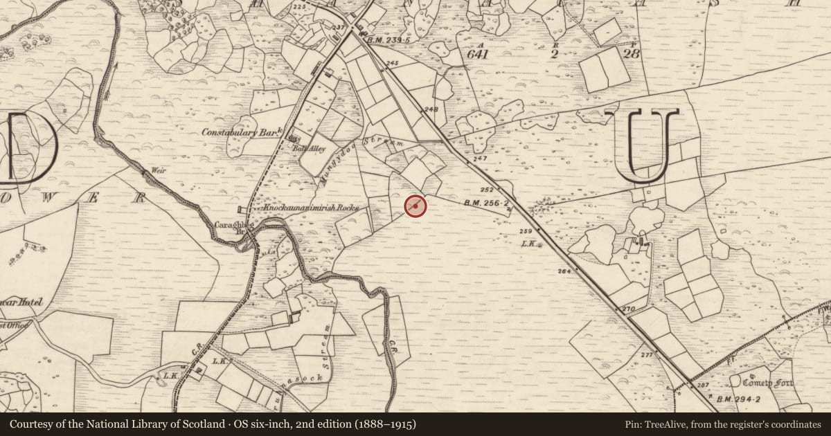
Slide toward Today to fade the historical sheet and see the modern map underneath.
David Rumsey Map Collection, Stanford LibrariesDavid Rumsey Map Collection, Stanford LibrariesDavid Rumsey Map Collection, Stanford LibrariesDavid Rumsey Map Collection, Stanford Libraries
4 historical maps cover this location, the earliest the 1790 map "Composite: Ireland." (David Rumsey Map Collection, Stanford Libraries).
Historical maps covering this location
- 1790 · Composite: Ireland. (David Rumsey Map Collection, Stanford Libraries)
- 1841 · Ireland. (David Rumsey Map Collection, Stanford Libraries)
- 1869 · Ireland. (David Rumsey Map Collection, Stanford Libraries)
- 1891 · Ireland 16 (David Rumsey Map Collection, Stanford Libraries)
This record in the National Monuments Service's Historic Environment Viewer ↗
The National Monuments Service's description
Two slabs lie at the S side of a field fence, beneath a dense growth of furze bushes, in rough boggy land on the S side of Knocknamorrive hill, E of the Caragh river. Cooke recorded a third stone at this location but this cannot now be located.
(1)(KE072-017----) The decorated surface of this rectangular block, which measures 1.22m .4m .2m, is flat. The well-preserved motifs include two cup-and-rings, three cup-and-two rings and one cup-and-three rings. In each case the rings are penannular, and in two instances radial grooves extend from the cupmarks. There are, in addition, six simple cupmarks and a number of grooves, one of which extends along the centre of the slab for about half of its length.
(2)(KE072-017001-) The decoration on this slab, which measures 1.3m .5m, is confined to one of its ends and is dominated by a cup-and-two penannular rings with a radial groove. This groove is intersected by a curved groove which joins a cup-and-ring and a cupmark with a short groove, enclosed in an arc.
(3)(KE072-017002-) Cooke described this stone as roughly rectangular, 19 inches by 15 inches (.48m .38m), and featuring a cup-and-ring linked to a subrectangular grid pattern (1906, 11).
The above description is derived from A. O'Sullivan and J. Sheehan (compilers), 'The Iveragh peninsula: an archaeological survey of South Kerry'. Cork University Press (1996), no. 359. In certain instances the entries have been revised and updated in the light of recent research.
Date of upload: 1 August 2013
In rough, level pasture (80m OD), on S side of field boundary (long-axis NE-SW); A relatively recent breach (Wth c. 4m) has been made in the boundary, adjacent to W of the rock art location. A smooth and fractured sandstone (dims. 1.22m N-S; 0.40m E-W; T 0.18m) lying flat upon ground surface. This stone has a flat, rectangular decorated surface (dims. 1.03m NW-SE; 0.20m NE-SW) that is facing upwards. A pen-annular cup-and-two-ring motif (overall diam. 18cm; ring Wth 1.5cm; D 4mm; cup diam. 8cm; D 11mm) is located off-centre to N, at E edge; Radial groove (dims. L 8cm; Wth 1cm; D 4mm) extends from cupmark at W. Two single cupmarks are adjacent to N and a pen-annular cup-and-two-ring motif (overall diam. 14cm; ring Wth 1cm; D 4mm; cup diam. 5cm; D 8mm) is adjacent to S. The inner ring is very difficult to decipher and has merged with the cupmark, possibly due to weathering. A pen-annular cup-and-three-ring motif (overall dims. diam. 21cm; ring Wth 1cm; D 3-4mm; cup diam. 9cm; D 10mm) is adjacent to S; A radial groove (dims. L 8cm; Wth 1cm; D 3-4mm) extends from the cupmark at NW. A cupmark (diam. 5cm; D 3mm) is located to S of cup-and-three-ring motif. A linear groove (dims. L 57cm N-S; Wth 2cm; D 5mm) (long-axis N-S) bisects the S-half of the stone and splits at the its N end, taking a right angle (L 10cm) to W and (L 21cm) to E. A cup-and-two-ring motif (overall diam. 15cm; ring Wth 1cm; D 5mm; cup diam. 8cm; D 12mm) abuts the W side of this linear groove, toward the S end. A previously unrecorded cupmark (diam. 4cm; D 4mm) is adjacent to S, which had not previously been recorded by O’Sullivan & Sheehan (1996, 106). A partial cup-and-ring motif and three cupmarks are adjacent to N. A partial cup-and-ring motif and intersecting linear grooves are toward northern end of decorated surface. According to the SMR file and local information, this stone is ex-situ and was moved close to the field boundary during land clearance in modern times. Rock art (KE072-017001-) is located c. 0.6m to E.
Compiled by: Alison McQueen and Vera Rahilly
Date of upload: 5 July 2017
Nearby in the register
- Rock artunder 1 mi
- Rock artunder 1 mi
- Souterrainunder 1 mi
- Ringfort - cashelunder 1 mi
Other entries of the same register within about three miles of this one, by straight line.