Sites and Monuments Record · Ireland
Cross
Cruach Na Cara, County Galway, Ireland
The record
- Townland
- Cruach Na Cara
- County
- Galway
- Country
- Ireland
- First-edition OS map
- Not indicated
- Latest-edition OS map
- Not indicated
- Coordinates
- 53.30463, -9.91722
- SMR number
- GA076-020016-
Slide toward Today to fade the historical sheet and see the modern map underneath.
David Rumsey Map Collection, Stanford LibrariesDavid Rumsey Map Collection, Stanford LibrariesDavid Rumsey Map Collection, Stanford LibrariesDavid Rumsey Map Collection, Stanford Libraries
4 historical maps cover this location, the earliest the 1753 map "Mappa geographica Regni Hiberniae" (David Rumsey Map Collection, Stanford Libraries).
Historical maps covering this location
- 1753 · Mappa geographica Regni Hiberniae (David Rumsey Map Collection, Stanford Libraries)
- 1790 · Composite: Ireland. (David Rumsey Map Collection, Stanford Libraries)
- 1869 · Ireland. (David Rumsey Map Collection, Stanford Libraries)
- 1891 · Ireland 16 (David Rumsey Map Collection, Stanford Libraries)
This record in the National Monuments Service's Historic Environment Viewer ↗
The National Monuments Service's description
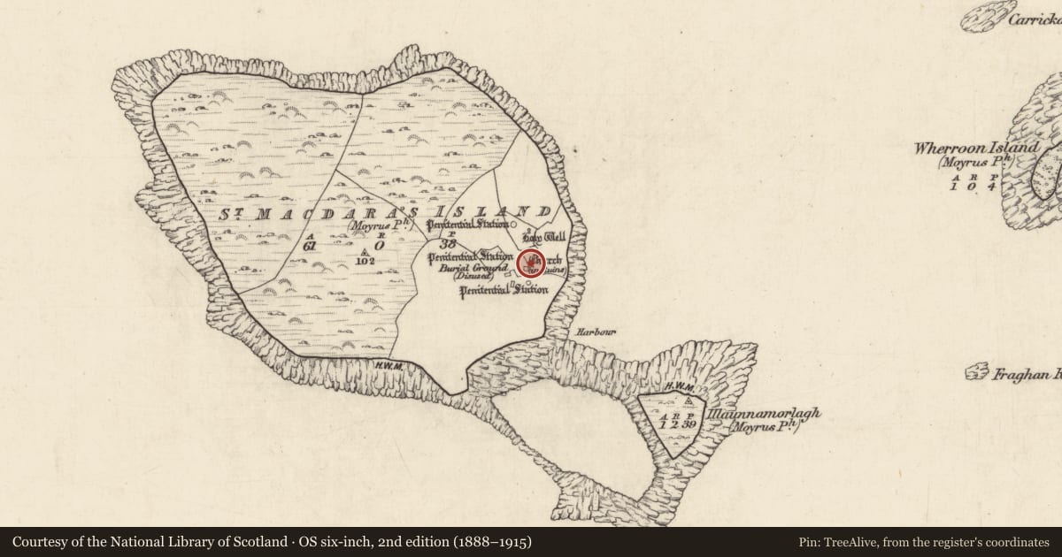
Associated with the ecclesiastical remains at the SE end of Cruach na Cara/St Macdara’s Island and located within the enclosure (GA076-020014-) c. 20m to the NE of the church (GA076-020001-). Kinehan (1869, 90-91) recorded ‘a rectangular piece of limestone carved on both sides’ on the leacht (GA076-020010-) and noted that it may have been ‘part of the shaft of a cross’. He also noted that ‘the socket of the shaft of a cross’ at the side of the leacht ‘fits this piece.’ A rectangular limestone fragment (L 0.42m; Wth 0.32m; T 0.1m) was noted on the leacht but it was undecorated (see also GA076-020024- and GA076-020025-). The rectangular limestone socket (L 0.4m; Wth 0.14-0.19m) is visible on the ground to the SE of the cross-slab (GA076-020009-). (Bigger 1896, 109)
Compiled by: Olive Alcock
Date of upload: 7 June 2018
References
Bigger, F.J. 1896 Cruach Mac Dara, off the coast of Connamara: with a notice of its church, crosses, and antiquities. Journal of the Royal Society of Antiquaries of Ireland 26, 101-12.
Kinahan, G.H. 1868c Proceedings: Church on Illaun-Dara, near Roundstone, Co. Galway. Journal of the Royal Society of Antiquaries of Ireland 10, 89-91.
Nearby in the register
- Cross-slabunder 1 mi
- Leachtunder 1 mi
- Cursing stoneunder 1 mi
- Crossunder 1 mi
Other entries of the same register within about three miles of this one, by straight line.