Sites and Monuments Record · Ireland
Cross-slab
Cruach Na Cara, County Galway, Ireland
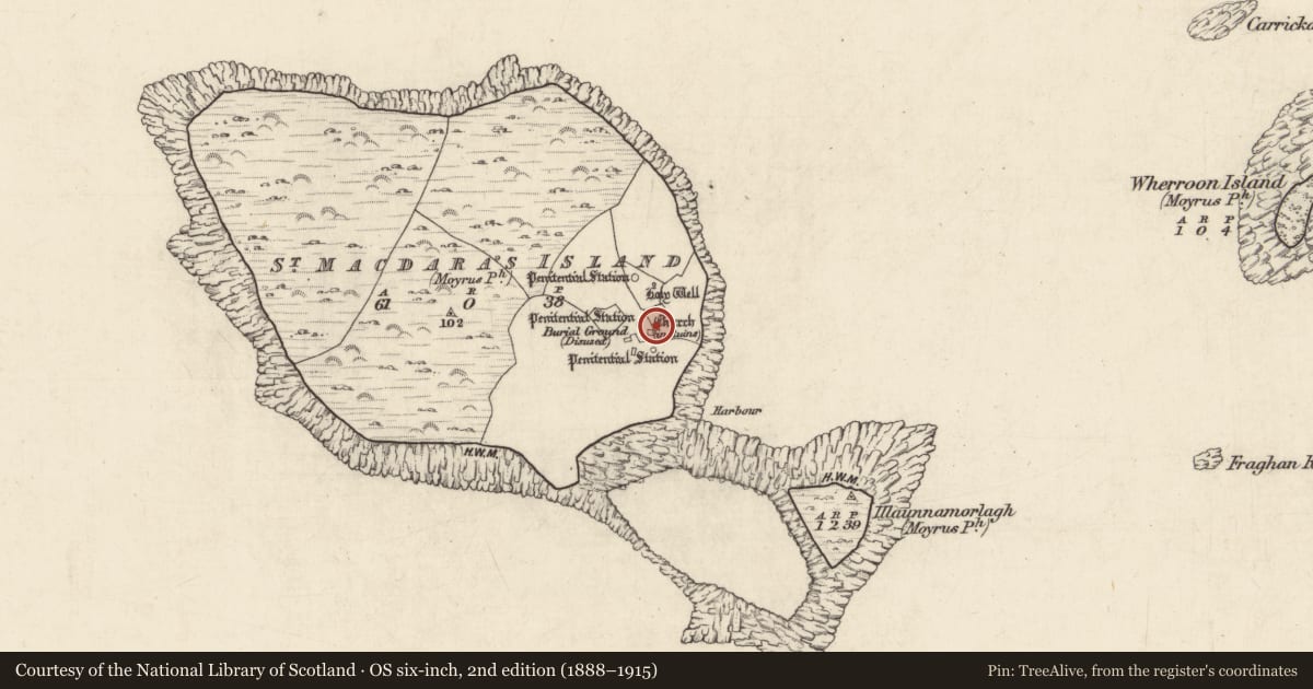
The record
- Townland
- Cruach Na Cara
- County
- Galway
- Country
- Ireland
- First-edition OS map
- Not indicated
- Latest-edition OS map
- Not indicated
- Coordinates
- 53.30463, -9.91722
- SMR number
- GA076-020009-
Slide toward Today to fade the historical sheet and see the modern map underneath.
David Rumsey Map Collection, Stanford LibrariesDavid Rumsey Map Collection, Stanford LibrariesDavid Rumsey Map Collection, Stanford LibrariesDavid Rumsey Map Collection, Stanford Libraries
4 historical maps cover this location, the earliest the 1753 map "Mappa geographica Regni Hiberniae" (David Rumsey Map Collection, Stanford Libraries).
Historical maps covering this location
- 1753 · Mappa geographica Regni Hiberniae (David Rumsey Map Collection, Stanford Libraries)
- 1790 · Composite: Ireland. (David Rumsey Map Collection, Stanford Libraries)
- 1869 · Ireland. (David Rumsey Map Collection, Stanford Libraries)
- 1891 · Ireland 16 (David Rumsey Map Collection, Stanford Libraries)
This record in the National Monuments Service's Historic Environment Viewer ↗
The National Monuments Service's description
Associated with the ecclesiastical remains at the SE end of Cruach na Cara/St Macdara’s Island. Located within an enclosure (GA076-020014-), c. 20m to the NE of the church (GA076-020001-). When recorded by Bigger (1896, 109), this plain limestone cross-slab (H 1.1m; max. Wth 0.58m; Wth of shaft 0.45m; T 0.07m) was upright on top of a leacht (GA076-020010-). It is now set in the ground c. 3m to its SSE. Described by Higgins (1987, ii 389, no. 109) as a straight-sided slab with ‘gently sloping shoulders which expand into a large, irregularly-shaped protrusion or end.’ This suggests that, in its present form and when it was on the leacht, the cross-slab is inverted in the ground. An irregular groove is visible running across the centre of the upper area of the slab. A small spherical granite boulder on the ground to its W may be a cursing stone (see GA076-020026-) that was formerly located on the leacht. (Gosling 1993, 172, no. 997 c)
Compiled by: Olive Alcock
Date of upload: 6 June 2018
References
Higgins, J.G. 1987 The Early Christian cross slabs, pillar stones and related monuments of County Galway, Ireland, 2 vols. British Archaeological Reports, International Series 375. Oxford.
Gosling, P. (compiler) 1993 Archaeological inventory of County Galway, vol. 1: West Galway. Dublin. Stationery Office.
Bigger, F.J. 1896 Cruach Mac Dara, off the coast of Connamara: with a notice of its church, crosses, and antiquities. Journal of the Royal Society of Antiquaries of Ireland 26, 101-12.
Nearby in the register
- Leachtunder 1 mi
- Crossunder 1 mi
- Cursing stoneunder 1 mi
- Crossunder 1 mi
Other entries of the same register within about three miles of this one, by straight line.