Sites and Monuments Record · Ireland
Font
Killiney, County Dublin, Ireland
The record
- Townland
- Killiney
- County
- Dublin
- Country
- Ireland
- First-edition OS map
- Not indicated
- Latest-edition OS map
- Not indicated
- Coordinates
- 53.25470, -6.11631
- SMR number
- DU026-013005-
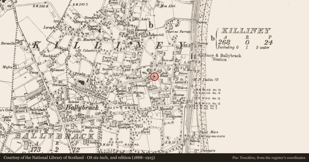
Slide toward Today to fade the historical sheet and see the modern map underneath.
David Rumsey Map Collection, Stanford LibrariesDavid Rumsey Map Collection, Stanford LibrariesDavid Rumsey Map Collection, Stanford LibrariesDavid Rumsey Map Collection, Stanford Libraries
4 historical maps cover this location, the earliest the 1799 map "Ireland." (David Rumsey Map Collection, Stanford Libraries).
Historical maps covering this location
- 1799 · Ireland. (David Rumsey Map Collection, Stanford Libraries)
- 1811 · Ireland. (David Rumsey Map Collection, Stanford Libraries)
- 1841 · Ireland. (David Rumsey Map Collection, Stanford Libraries)
- 1891 · Ireland 16 (David Rumsey Map Collection, Stanford Libraries)
This record in the National Monuments Service's Historic Environment Viewer ↗
The National Monuments Service's description
Killiney church ruins are located on the Marino Avenue West, leading E off Killiney Hill road. Medieval baptismal font of Killiney (Cill Iníon Léinín/church of the seven daughters of Léinín) monastery founded in the 6th-century by its patron saint Aighleann and her sisters, now standing inside the church ruins (DU026-013001-) in Killiney graveyard (DU026-013002-), Co. Dublin. Remains consist of a roughly circular-shaped or bowl-shaped granite font (diam. 0.46m) standing on the floor of the N aisle of the medieval church of Killiney.
To see a 3D model of this font, visit: https://skfb.ly/oEzyU
Compiled by: Geraldine Stout and Padraig Clancy
Revised by: Caimin O'Brien
Date of revised upload: 31 March 2023
Nearby in the register
- Ecclesiastical siteunder 1 mi
- Churchunder 1 mi
- Ecclesiastical enclosureunder 1 mi
- Crossunder 1 mi
Other entries of the same register within about three miles of this one, by straight line.