Sites and Monuments Record · Ireland
Country house
Baltydaniel East, County Cork, Ireland
The record
- Townland
- Baltydaniel East
- County
- Cork
- Country
- Ireland
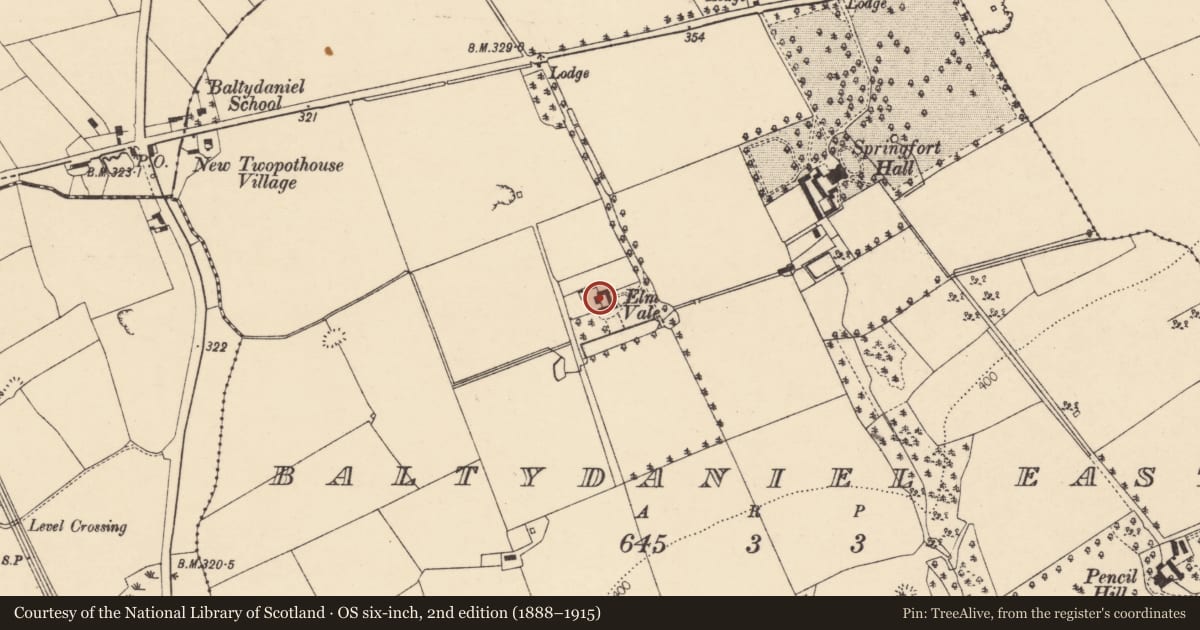
- Latest-edition OS map
- Elm Vale (1937)
- Coordinates
- 52.18369, -8.66185
- SMR number
- CO025-050----
Slide toward Today to fade the historical sheet and see the modern map underneath.
David Rumsey Map Collection, Stanford LibrariesDavid Rumsey Map Collection, Stanford LibrariesDavid Rumsey Map Collection, Stanford LibrariesDavid Rumsey Map Collection, Stanford Libraries
4 historical maps cover this location, the earliest the 1790 map "Composite: Ireland." (David Rumsey Map Collection, Stanford Libraries).
Historical maps covering this location
- 1790 · Composite: Ireland. (David Rumsey Map Collection, Stanford Libraries)
- 1882 · Ireland (southern half). (David Rumsey Map Collection, Stanford Libraries)
- 1883 · Ireland 3. (David Rumsey Map Collection, Stanford Libraries)
- 1904 · Sheet 13. (David Rumsey Map Collection, Stanford Libraries)
This record in the National Monuments Service's Historic Environment Viewer ↗
The National Monuments Service's description
Two-storey house, over basement. Walls rendered over random-rubble limestone. Entrance front (S) of 5 bays; ashlar quoins exposed and moulded stone cornice under eaves; central segmental-arched door ope with sidelights incorporated into frame; steps up to door; camber-headed window opes. Gable-ended with chimneys on gables. Lower gabled additions extend from gable ends and prolong front elevation. Small round-headed stairway window on rear elevation. Brick-arched fireplace in basement, in E end wall of house, with adjacent circular brick-domed bread ovens (D 0.87m; H 0.44m) and niches. According to owner, rebuilt as Dower House for nearby Springfort Hall in 1722; however, windows and door on front elevation mid-19th century in appearance. Range of 2-storey farm buildings around yard to rear, with oval stone plaque inscribed "C W Wyatt/October/1853" (Grove White 1905-25, vol. 3, 102).
The above description is derived from the published 'Archaeological Inventory of County Cork. Volume 4: North Cork' (Dublin: Stationery Office, 2000). In certain instances the entries have been revised and updated in the light of recent research.
Date of upload/revision: 14 January 2009
Nearby in the register
- Burnt moundunder 1 mi
- Ringfort - rathunder 1 mi
- Ringfort - rathunder 1 mi
- Fulacht fiaunder 1 mi
Other entries of the same register within about three miles of this one, by straight line.