Sites and Monuments Record · Ireland
Ringfort - cashel
Poulgorm, County Clare, Ireland
The record
- Townland
- Poulgorm
- County
- Clare
- Country
- Ireland
- First-edition OS map
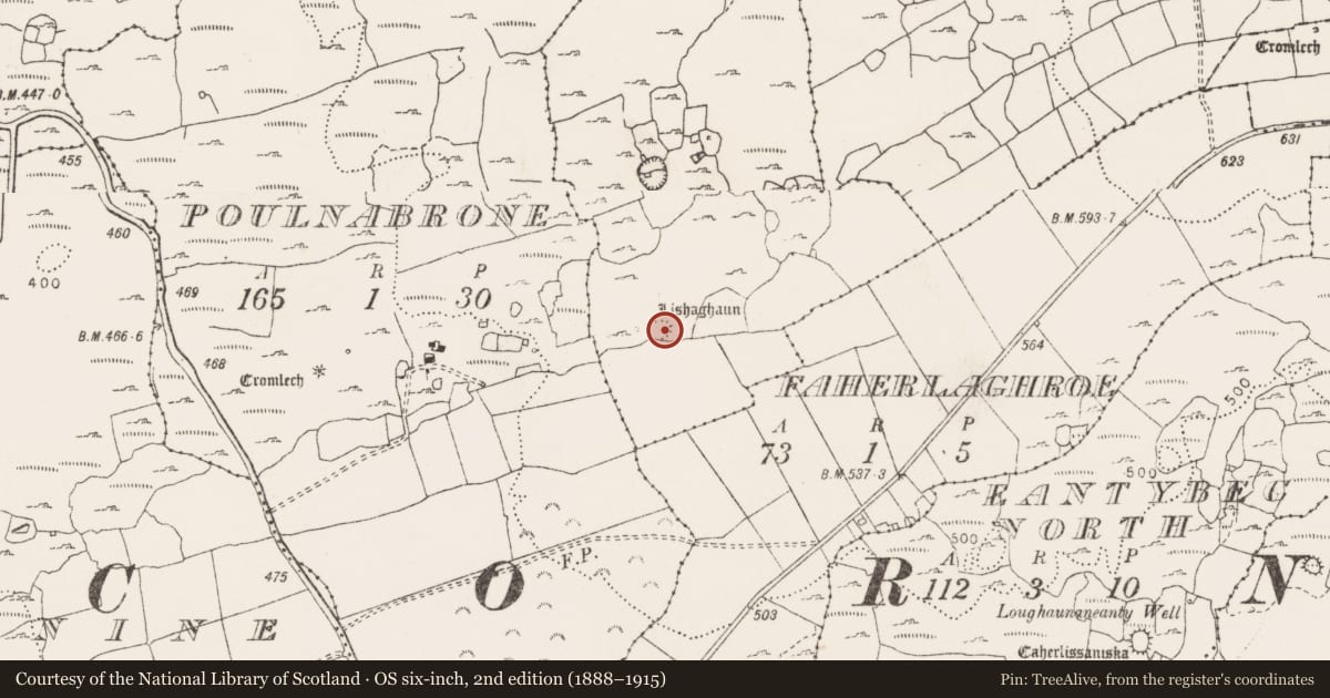
- Lishaghaun
- Latest-edition OS map
- Lishaghaun (1916)
- Coordinates
- 53.04916, -9.13348
- SMR number
- CL009-035----
Slide toward Today to fade the historical sheet and see the modern map underneath.
David Rumsey Map Collection, Stanford LibrariesDavid Rumsey Map Collection, Stanford LibrariesDavid Rumsey Map Collection, Stanford LibrariesDavid Rumsey Map Collection, Stanford Libraries
4 historical maps cover this location, the earliest the 1753 map "Mappa geographica Regni Hiberniae" (David Rumsey Map Collection, Stanford Libraries).
Historical maps covering this location
- 1753 · Mappa geographica Regni Hiberniae (David Rumsey Map Collection, Stanford Libraries)
- 1790 · Composite: Ireland. (David Rumsey Map Collection, Stanford Libraries)
- 1869 · Ireland. (David Rumsey Map Collection, Stanford Libraries)
- 1891 · Ireland 16 (David Rumsey Map Collection, Stanford Libraries)
This record in the National Monuments Service's Historic Environment Viewer ↗
The National Monuments Service's description
On a shelf near the SE foot of a steep ridge overlooking a narrow valley to the E, and a nearby pond on lower ground to the W. Hachured and labelled ‘Lishaghaun’ on both the first (1842) and Cassini (1920) editions of the OS 6-inch map. Labelled ‘Liosachán’ on Robinson’s map of the Burren (1977). Listed as ‘Enclosure’ in the RMP (1996). This circular cashel (diams. 25.8m E–W; 25.5m N–S) is defined by a double-faced dry-stone wall (Wth at N 3m; int. H 0.3–0.9m; ext. H 0.3–1m) with a possible clay core. The outer wall-face is visible intermittently while the inner wall-face is traceable from NW–N. A later wall is built over the cashel wall from SSE–S-SW. There is an entrance gap (Wth 1m) at ESE.
Another cashel (CL005-160002-) lies c. 175m to N.
Compiled by: Gearóid Conroy and Conn Herriott
Date of upload: 30-9-2025
References
Robinson, T. 1977 (reprint 1999) The Burren: a two-inch map of the uplands of North-West Clare. Map Scale 1:31680. Roundstone: Folding Landscapes.
Nearby in the register
- House - indeterminate dateunder 1 mi
- Enclosureunder 1 mi
- House - indeterminate dateunder 1 mi
- Ringfort - cashelunder 1 mi
Other entries of the same register within about three miles of this one, by straight line.