Cof Cymru: National Historic Assets of Wales · Wales
Little Haven Enclosed Settlement
The Havens, Pembrokeshire, Wales
A scheduled monument in The Havens, Pembrokeshire, recorded as Unenclosed hut circle settlement (Prehistoric).
The record
- Designation
- Scheduled monument
- Site type
- Unenclosed hut circle settlement
- Period
- Prehistoric
- Date of designation
- 9 February 1994
- Community
- The Havens
- Unitary authority
- Pembrokeshire
- Country
- Wales
- Coordinates (centre of the scheduled area)
- 51.76893, -5.11321
- SAM number
- PE456
- Cadw record number
- 2091
Slide toward Today to fade the historical sheet and see the modern map underneath.
David Rumsey Map Collection, Stanford LibrariesDavid Rumsey Map Collection, Stanford LibrariesDavid Rumsey Map Collection, Stanford LibrariesDavid Rumsey Map Collection, Stanford LibrariesDavid Rumsey Map Collection, Stanford Libraries
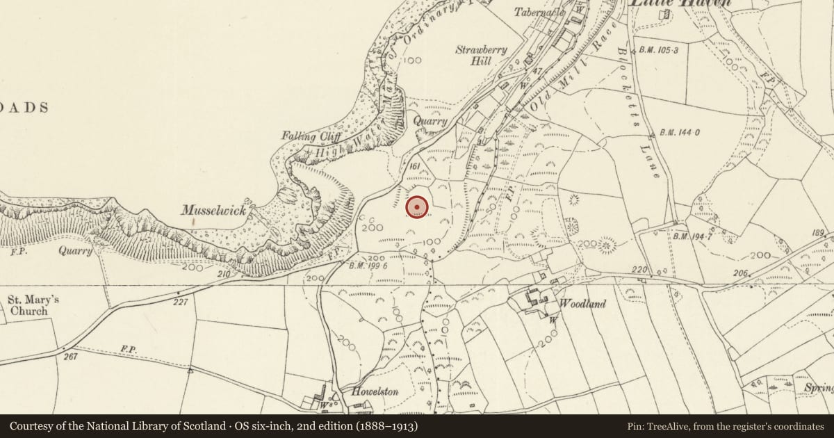
5 historical maps cover this location, the earliest the 1608 map "(13) Cambriae Typus." (David Rumsey Map Collection, Stanford Libraries).
Historical maps covering this location
- 1608 · (13) Cambriae Typus. (David Rumsey Map Collection, Stanford Libraries)
- 1636 · Cornubia : Devonia, Somersetus, Dorcestria, Wiltonia, Glocestria ... (David Rumsey Map Collection, Stanford Libraries)
- 1898 · 227 Milford (Hills) (David Rumsey Map Collection, Stanford Libraries)
- 1898 · 227 Milford (Outline) (David Rumsey Map Collection, Stanford Libraries)
- 1901 · Sheet 13. (David Rumsey Map Collection, Stanford Libraries)
Cadw's description
Summary description and reason for designation
The following provides a general description of the Scheduled Ancient Monument.
The monument comprises the remains of a group of hut circles that probably date to the Iron Age or Romano-British period (c. 800 BC - AD 400). This is a sub-rectangular enclosed settlement immediately south of the Little Haven Hotel. It measures c. 85m N-S and 50m internally. The western side is defended by a substantial earth and stone bank standing up to 3m high. There is a near central entrance where the banks turn inwards. The defensive bank is lower or absent on the other side where the land drops steeply into a stream valley. The interior has terraced areas and quarry pits but partial excavations in the 1950s revealed a round and rectangular hut.
The monument is of national importance for its potential to enhance our knowledge of later prehistoric domestic construction practices. The monument retains significant archaeological potential and there is a strong probability that structural evidence has survived, together with internal and external floor surfaces.
The scheduled area comprises the remains described and areas around them within which related evidence may be expected to survive.
Nearby in the register
- Howelston Defended EnclosurePromontory Fort - inlandunder 1 mi
- Woodland RathRathunder 1 mi
- Manor HouseDomesticunder 1 mi
- Haven Fort HotelCommercialunder 1 mi
Other entries of the same register within about three miles of this one, by straight line.