Cof Cymru: National Historic Assets of Wales · Wales
Woodland Rath
The Havens, Pembrokeshire, Wales
A scheduled monument in The Havens, Pembrokeshire, recorded as Rath (Prehistoric).
The record
- Designation
- Scheduled monument
- Site type
- Rath
- Period
- Prehistoric
- Date of designation
- 7 June 1950
- Community
- The Havens
- Unitary authority
- Pembrokeshire
- Country
- Wales
- Coordinates (centre of the scheduled area)
- 51.76371, -5.11076
- SAM number
- PE191
- Cadw record number
- 3036
Slide toward Today to fade the historical sheet and see the modern map underneath.
David Rumsey Map Collection, Stanford LibrariesDavid Rumsey Map Collection, Stanford LibrariesDavid Rumsey Map Collection, Stanford LibrariesDavid Rumsey Map Collection, Stanford LibrariesDavid Rumsey Map Collection, Stanford Libraries
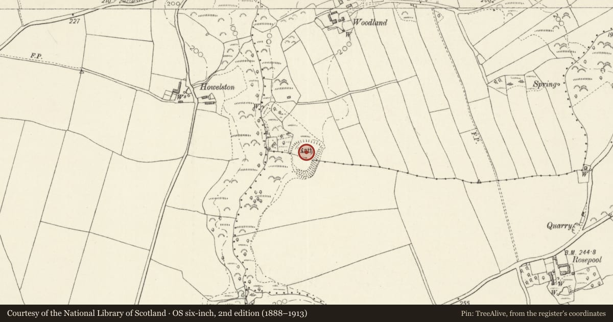
5 historical maps cover this location, the earliest the 1608 map "(13) Cambriae Typus." (David Rumsey Map Collection, Stanford Libraries).
Historical maps covering this location
- 1608 · (13) Cambriae Typus. (David Rumsey Map Collection, Stanford Libraries)
- 1636 · Cornubia : Devonia, Somersetus, Dorcestria, Wiltonia, Glocestria ... (David Rumsey Map Collection, Stanford Libraries)
- 1898 · 227 Milford (Hills) (David Rumsey Map Collection, Stanford Libraries)
- 1898 · 227 Milford (Outline) (David Rumsey Map Collection, Stanford Libraries)
- 1901 · Sheet 13. (David Rumsey Map Collection, Stanford Libraries)
Cadw's description
Summary description and reason for designation
The following provides a general description of the Scheduled Ancient Monument.
The monument comprises a small defended enclosure or rath, which probably dates to the Iron Age period (800 BC - 43 AD). Usually enclosed by a bank and ditch, raths often contsin evidence of intensive occupation. Woodland Rath is a sub-circular enclosure measuring c.90m north to south by and 70m east to west. It is enclosed by a single bank and ditch, on the west where the land falls away steeply into a minor valley the defences are enhanced by the steep slope. The main bank and ditch is best preserved on the south and east sides, extending over 21m in width with the bank standing up to 2.3m above the interior and 5m above the base of the ditch. The ditch survives to c.1.6m deep. On the north side the bank has been plough-levelled and survives only as a steep scarp, although traces of the ditch and a counterscarp bank which also continues around the western side are visible in aerial photographs. A scarp slope running from the northeast corner of the site towards the northwest may be a natural feature, or part of the defences. A simple gap on the northeast corner of the enclosure marks the entrance.
The monument is of national importance for its potential to enhance our knowledge of Iron Age settlement and social organisation. The monument forms an important element within the wider later prehistoric landscape. The structure itself may be expected to contain archaeological information in regard to chronology, building techniques and functional detail.
The scheduled area comprises the remains described and areas around them within which related evidence may be expected to survive.
Nearby in the register
- Howelston Defended EnclosurePromontory Fort - inlandunder 1 mi
- Woodland Round BarrowRound Barrowunder 1 mi
- Little Haven Enclosed SettlementUnenclosed hut circle settlementunder 1 mi
- RosepoolDomesticunder 1 mi
Other entries of the same register within about three miles of this one, by straight line.