Cof Cymru: National Historic Assets of Wales · Wales
Defensible Barracks, Pembroke Dock
Pembroke Dock, Pembrokeshire, Wales
A scheduled monument in Pembroke Dock, Pembrokeshire, recorded as Barracks (Post Medieval/Modern).
The record
- Designation
- Scheduled monument
- Site type
- Barracks
- Period
- Post Medieval/Modern
- Community
- Pembroke Dock
- Unitary authority
- Pembrokeshire
- Country
- Wales
- Coordinates (centre of the scheduled area)
- 51.68936, -4.95185
- SAM number
- PE379
- Cadw record number
- 3076
Slide toward Today to fade the historical sheet and see the modern map underneath.
David Rumsey Map Collection, Stanford LibrariesDavid Rumsey Map Collection, Stanford LibrariesDavid Rumsey Map Collection, Stanford LibrariesUniversity Library, Vrije Universiteit AmsterdamDavid Rumsey Map Collection, Stanford Libraries
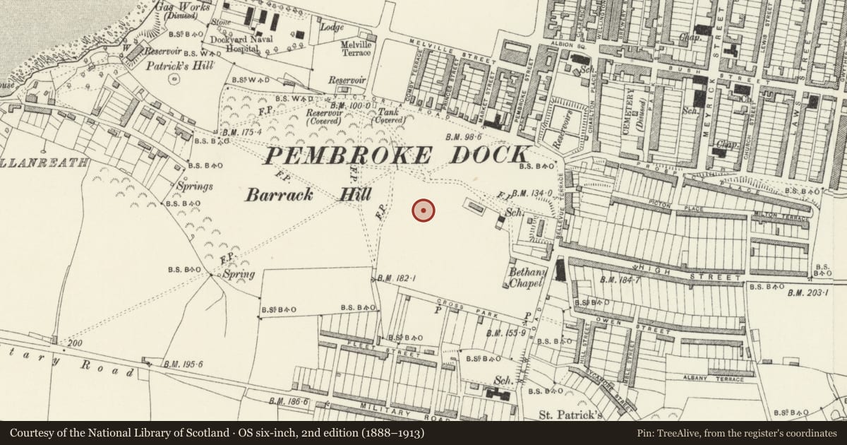
5 historical maps cover this location, the earliest the 1608 map "(13) Cambriae Typus." (David Rumsey Map Collection, Stanford Libraries).
Historical maps covering this location
- 1608 · (13) Cambriae Typus. (David Rumsey Map Collection, Stanford Libraries)
- 1636 · Cornubia : Devonia, Somersetus, Dorcestria, Wiltonia, Glocestria ... (David Rumsey Map Collection, Stanford Libraries)
- 1891 · Sheet 10. Ordnance Survey of England and Wales. . (David Rumsey Map Collection, Stanford Libraries)
- 1901 · Sheet 13. (David Rumsey Map Collection, Stanford Libraries)
- Sheet 7 South Wales (University Library, Vrije Universiteit Amsterdam)
Cadw's description
Summary description and reason for designation
The following provides a general description of the Scheduled Ancient Monument.
The monument comprises the remains of a nineteenth century defensible barracks. Located on Barrack Hill, the site has a commanding view of the dockyard at Pembroke Dock. The barracks were constructed in 1841-46 and housed the Royal Marines who were tasked with protecting the dockyard.
The barracks consist of a defensive square structure with projecting bastions on each corner surrounded by a dry moat. Within the defensible barracks, a central square parade area was enclosed by blocks of barrack rooms, mess areas, magazines and gun sheds. The basements contained areas for laundry, stores, latrines and magazines. The layout of the site probably represents the last example of a ‘square bastion trace’ fortification built in Europe.
The monument is of national importance for its potential to enhance our knowledge of post-medieval/modern aspects of warfare and politics.
The scheduled area comprises the remains described and an area around them within which related evidence may be expected to survive.
Nearby in the register
- Dry-Moat WallsDefenceunder 1 mi
- Barracks PlatformDefenceunder 1 mi
- The Defensible BarracksDefenceunder 1 mi
- Former National School (Now Employment Exchange)Educationunder 1 mi
Other entries of the same register within about three miles of this one, by straight line.