Cof Cymru: National Historic Assets of Wales · Wales
Bridge at Kennel Wood
Slebech, Pembrokeshire, Wales
A Grade II listed building in Picton Park, Slebech, Pembrokeshire, designated on 26 February 1998.
The record
- Designation
- Listed building, Grade II
- Broad class
- Transport
- Date of designation
- 26 February 1998
- Locality
- Picton Park
- Community
- Slebech
- Unitary authority
- Pembrokeshire
- Country
- Wales
- Coordinates
- 51.77895, -4.88776
- Cadw reference
- 19423
Slide toward Today to fade the historical sheet and see the modern map underneath.
David Rumsey Map Collection, Stanford LibrariesDavid Rumsey Map Collection, Stanford LibrariesDavid Rumsey Map Collection, Stanford LibrariesDavid Rumsey Map Collection, Stanford LibrariesDavid Rumsey Map Collection, Stanford Libraries
5 historical maps cover this location, the earliest the 1636 map "Cornubia : Devonia, Somersetus, Dorcestria, Wiltonia, Glocestria ..." (David Rumsey Map Collection, Stanford Libraries).
Historical maps covering this location
- 1636 · Cornubia : Devonia, Somersetus, Dorcestria, Wiltonia, Glocestria ... (David Rumsey Map Collection, Stanford Libraries)
- 1830 · V.3:11-15:XV. Britisches Reich. A. Kon: England. b. Frstenthum Wales: Shire: 37-40 (David Rumsey Map Collection, Stanford Libraries)
- 1891 · Sheet 10. Ordnance Survey of England and Wales. . (David Rumsey Map Collection, Stanford Libraries)
- 1898 · 228 Haverfordwest (Hills) (David Rumsey Map Collection, Stanford Libraries)
- 1901 · Sheet 13. (David Rumsey Map Collection, Stanford Libraries)
Cadw's description
Location
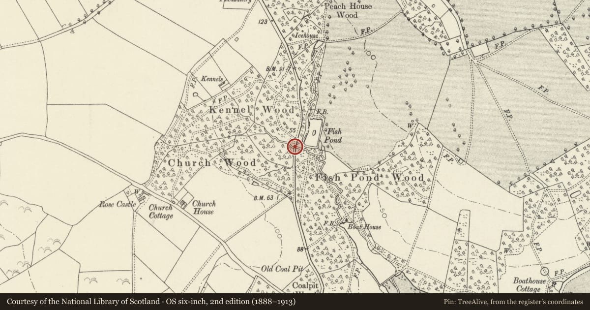
Bridge carrying the Picton Ferry - Rhos by-road through Kennel Wood. A kilometre N of Picton Ferry.
History
Small late C18 or early C19 embattled road bridge on the Picton Estate, forming an impressive approach to Picton Castle from Picton Ferry, the latter once the main ferry crossing over the Cleddau from Landshipping to the S.
Exterior
Rubble sandstone construction. Low and short parapet walls with pitched crenellations. The E parapet slightly curves. On both sides, the terminating merlon is taller. Small round-arched opening with stone voussoirs.
Reason for designation
Listed as an attractive bridge, clearly conceived in the 'Picturesque' taste of the period, forming an important part of the ongoing improvements of the Picton Estate.
Nearby in the register
- Walled Garden at Picton CastleDomesticunder 1 mi
- Picton CastleDomesticunder 1 mi
- Raised Terrace at East Entrance to Picton CastleDomesticunder 1 mi
- North Wing and Entrance Yard of Picton CastleDefenceunder 1 mi
Other entries of the same register within about three miles of this one, by straight line.