Cof Cymru: National Historic Assets of Wales · Wales
Rhyd-y-Gath Pillar Cross
Crymych, Pembrokeshire, Wales
A scheduled monument in Crymych, Pembrokeshire, recorded as Cross-marked stone (Early Medieval).
The record
- Designation
- Scheduled monument
- Site type
- Cross-marked stone
- Period
- Early Medieval
- Date of designation
- 31 March 1951
- Community
- Crymych
- Unitary authority
- Pembrokeshire
- Country
- Wales
- Coordinates (centre of the scheduled area)
- 51.95105, -4.59877
- SAM number
- PE233
- Cadw record number
- 3721
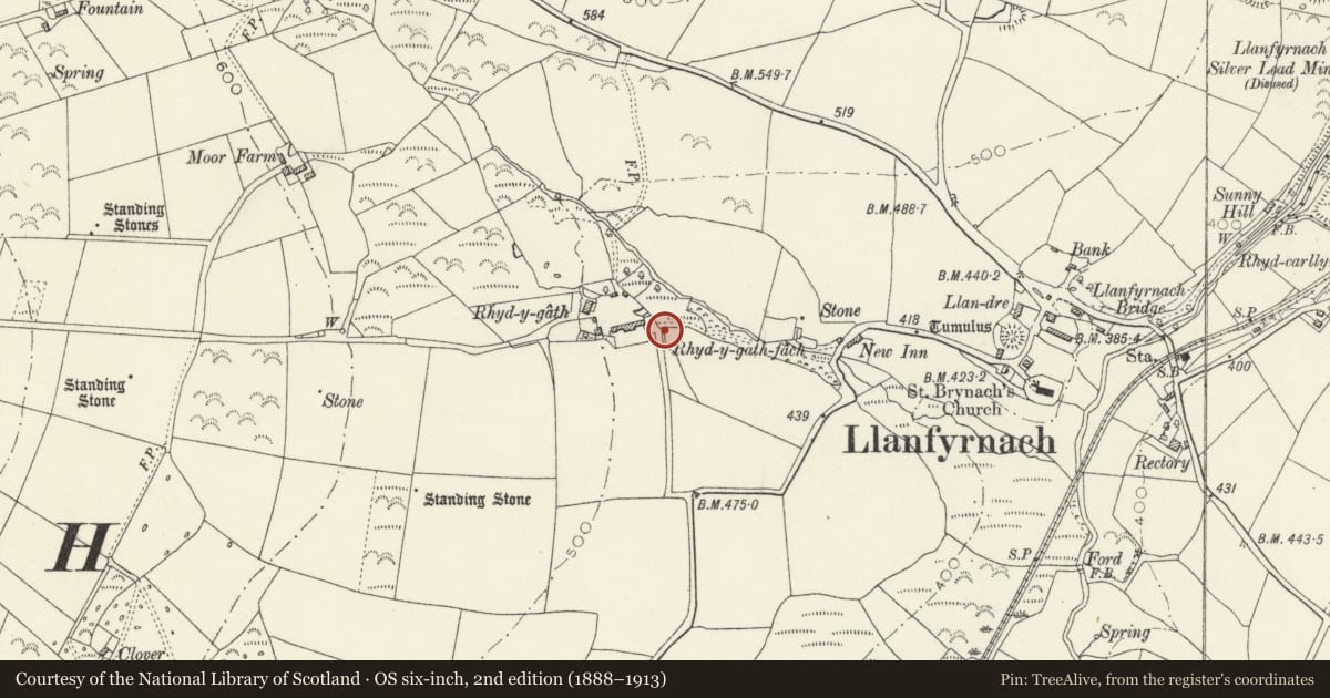
Slide toward Today to fade the historical sheet and see the modern map underneath.
David Rumsey Map Collection, Stanford LibrariesDavid Rumsey Map Collection, Stanford LibrariesDavid Rumsey Map Collection, Stanford LibrariesDavid Rumsey Map Collection, Stanford LibrariesDavid Rumsey Map Collection, Stanford Libraries
5 historical maps cover this location, the earliest the 1608 map "(13) Cambriae Typus." (David Rumsey Map Collection, Stanford Libraries).
Historical maps covering this location
- 1608 · (13) Cambriae Typus. (David Rumsey Map Collection, Stanford Libraries)
- 1636 · Cornubia : Devonia, Somersetus, Dorcestria, Wiltonia, Glocestria ... (David Rumsey Map Collection, Stanford Libraries)
- 1830 · V.3:11-15:XV. Britisches Reich. A. Kon: England. b. Frstenthum Wales: Shire: 37-40 (David Rumsey Map Collection, Stanford Libraries)
- 1891 · Sheet 10. Ordnance Survey of England and Wales. . (David Rumsey Map Collection, Stanford Libraries)
- 1898 · 211 Newcastle Emlyn (Hills) (David Rumsey Map Collection, Stanford Libraries)
Cadw's description
Summary description and reason for designation
The following provides a general description of the Scheduled Ancient Monument.
The monument consists of a stone with a cross carved into the surface, probably dating to the medieval period which has been incorporated into the body of a wall at the entrance to the farmyard. The rough unshaped stone has been incised with a cross and a circle which encompasses the arms but not the entire shaft of the cross. In each of the quarter circles formed by the carving is a dot device forming a symmetrical pattern.
The monument is of national importance for its potential to enhance our knowledge of the organisation and practice of medieval Christianity. It retains significant archaeological potential, with a strong probability of the presence of associated archaeological features and deposits. A cross marked stone may be part of a larger cluster of monuments and their importance can further enhanced by their group value.
The scheduled area comprises the remains described and areas around them within which related evidence may be expected to survive.
Nearby in the register
- Castle Mound, LlanfyrnachMotteunder 1 mi
- Entrance gates to churchyard of Church of St BrynachReligious, Ritual and Funeraryunder 1 mi
- Church of St BrynachReligious, Ritual and Funeraryunder 1 mi
- Llanfyrnach Standing StonesStanding Stoneunder 1 mi
Other entries of the same register within about three miles of this one, by straight line.