Cof Cymru: National Historic Assets of Wales · Wales
Llawhaden Hospital
Llawhaden, Pembrokeshire, Wales
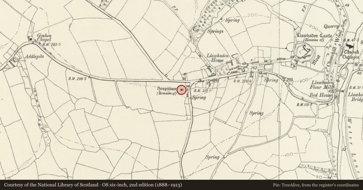
A scheduled monument in Llawhaden, Pembrokeshire, recorded as Hospital (Medieval).
The record
- Designation
- Scheduled monument
- Site type
- Hospital
- Period
- Medieval
- Community
- Llawhaden
- Unitary authority
- Pembrokeshire
- Country
- Wales
- Coordinates (centre of the scheduled area)
- 51.82067, -4.80629
- SAM number
- PE162
- Cadw record number
- 473
Slide toward Today to fade the historical sheet and see the modern map underneath.
David Rumsey Map Collection, Stanford LibrariesDavid Rumsey Map Collection, Stanford LibrariesDavid Rumsey Map Collection, Stanford LibrariesDavid Rumsey Map Collection, Stanford LibrariesDavid Rumsey Map Collection, Stanford Libraries
5 historical maps cover this location, the earliest the 1636 map "Cornubia : Devonia, Somersetus, Dorcestria, Wiltonia, Glocestria ..." (David Rumsey Map Collection, Stanford Libraries).
Historical maps covering this location
- 1636 · Cornubia : Devonia, Somersetus, Dorcestria, Wiltonia, Glocestria ... (David Rumsey Map Collection, Stanford Libraries)
- 1830 · V.3:11-15:XV. Britisches Reich. A. Kon: England. b. Frstenthum Wales: Shire: 37-40 (David Rumsey Map Collection, Stanford Libraries)
- 1891 · Sheet 10. Ordnance Survey of England and Wales. . (David Rumsey Map Collection, Stanford Libraries)
- 1898 · 228 Haverfordwest (Hills) (David Rumsey Map Collection, Stanford Libraries)
- 1901 · Sheet 13. (David Rumsey Map Collection, Stanford Libraries)
Cadw's description
Summary description and reason for designation
The following provides a general description of the Scheduled Ancient Monument.
The monument consists of the remains of a hospital dating to the medieval period. The hospital at Llawhaden was founded in 1287 by Bishop Bek and dedicated to St Mary the Virgin, St Thomas the Martyr and St Edward the King. Its charter recommends the care of pilgrims, paupers, aged persons and imbeciles. It was dissolved in the 16th century. The remains comprise a vaulted building and earlier foundations set within a rectangular ditched enclosure at least 50m square. The standing building is about 9.0m by 7.0m externally with walls 0.6m thick and stands to full height; it is built of uncoursed rubble from which the finer stone dressings have been robbed and is entered by a door on the north wall. Within there are two single light windows in the east and west walls and a piscina. Excavation has showed the present building is the second on the site and lies within the footings of an earlier more elaborate structure which extended 17m west of the west gable and which survives as rubble stone footings forming a building 9.5m wide. The earlier building also extends 7.8m east of the east gable where it is narrower at 7.2m wide and produced evidence for an altar, steps and benching. Finds included, painted wall plaster, painted glass and a silver coin.
The monument is of national importance for its potential to enhance our knowledge of healthcare systems. It retains significant archaeological potential, with a strong probability of the presence of associated archaeological features and deposits. The structure itself may be expected to contain archaeological information concerning chronology and building techniques.
The scheduled area comprises the remains described and areas around them within which related evidence may be expected to survive.
Nearby in the register
- Remains of Llawhaden HospitalHealth and Welfareunder 1 mi
- Wall with Tower and adjacent Pavement at Llawhaden HouseDomesticunder 1 mi
- Milking Shed at Llawhaden HouseAgriculture and Subsistenceunder 1 mi
- Cowhouse Range at Llawhaden HouseAgriculture and Subsistenceunder 1 mi
Other entries of the same register within about three miles of this one, by straight line.