Cof Cymru: National Historic Assets of Wales · Wales
Garn Gilfach Burial Chamber
Pencaer, Pembrokeshire, Wales
A scheduled monument in Pencaer, Pembrokeshire, recorded as Chambered Tomb (Prehistoric).
The record
- Designation
- Scheduled monument
- Site type
- Chambered Tomb
- Period
- Prehistoric
- Community
- Pencaer
- Unitary authority
- Pembrokeshire
- Country
- Wales
- Coordinates (centre of the scheduled area)
- 52.00983, -5.04830
- SAM number
- PE032
- Cadw record number
- 234
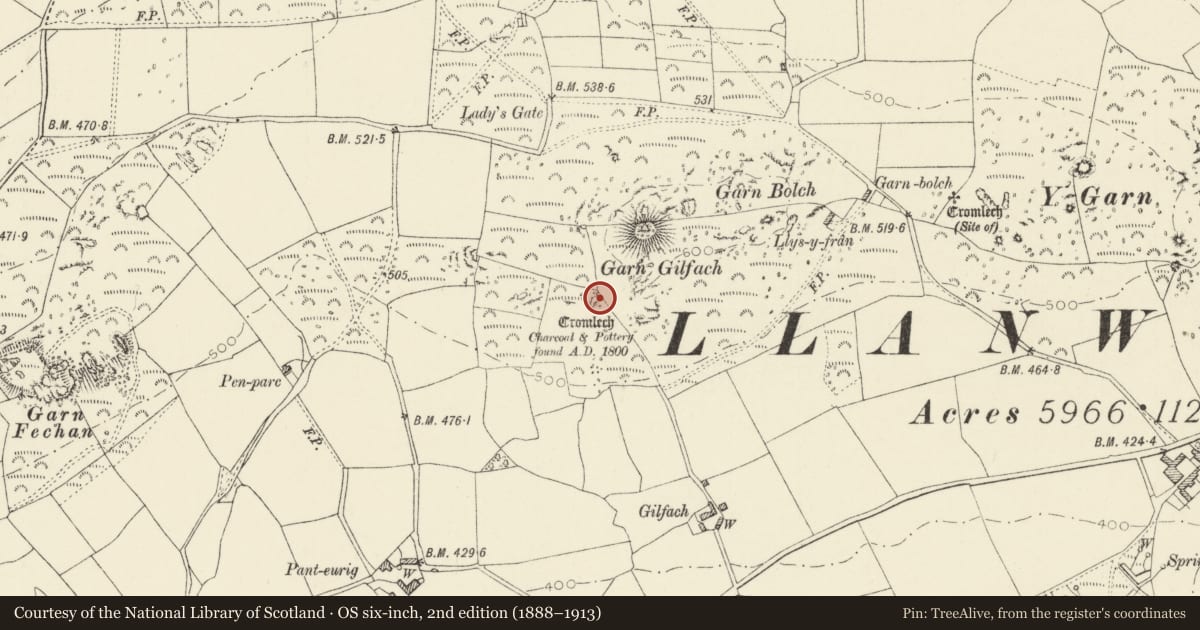
Slide toward Today to fade the historical sheet and see the modern map underneath.
David Rumsey Map Collection, Stanford LibrariesDavid Rumsey Map Collection, Stanford LibrariesDavid Rumsey Map Collection, Stanford LibrariesDavid Rumsey Map Collection, Stanford LibrariesDavid Rumsey Map Collection, Stanford Libraries
5 historical maps cover this location, the earliest the 1608 map "(13) Cambriae Typus." (David Rumsey Map Collection, Stanford Libraries).
Historical maps covering this location
- 1608 · (13) Cambriae Typus. (David Rumsey Map Collection, Stanford Libraries)
- 1636 · Cornubia : Devonia, Somersetus, Dorcestria, Wiltonia, Glocestria ... (David Rumsey Map Collection, Stanford Libraries)
- 1637 · Particular description of Wales. Cambria seu Wallia (David Rumsey Map Collection, Stanford Libraries)
- 1898 · 209 St David's (Hills) (David Rumsey Map Collection, Stanford Libraries)
- 1901 · Sheet 13. (David Rumsey Map Collection, Stanford Libraries)
Cadw's description
Summary description and reason for designation
The following provides a general description of the Scheduled Ancient Monument.
The monument comprises the remains of a chambered tomb, dating to the Neolithic period (c. 4,400 BC - 2,900 BC). Chambered tombs were built and used by local farming communities over long periods of time. There appear to be many regional traditions and variations in shape and construction.
The burial chamber is situated southeast of a natural rock outcrop and is dominated by its very large capstone which measures 4.7m in length, 4m wide and is 1.4m thick. The eastern side of the capstone is supported by two low uprights, with a third standing fractionally apart. The western and northern sides are supported by the sloping ground. An subterranean internal chamber, open to the south and measuring 3m square and 0.7m in height is formed by rough walling and further uprights
The monument is of national importance for its potential to enhance our knowledge of prehistoric burial and ritual. The monument is an important relic of a prehistoric funerary and ritual landscape and retains significant archaeological potential, with a strong probability of the presence of both intact burial or ritual deposits and environmental and structural evidence, including a buried prehistoric land surface. Chambered tombs may be part of a larger cluster of monuments and their importance can further enhanced by their group value.
The scheduled area comprises the remains described and areas around them within which related evidence may be expected to survive.
Nearby in the register
- PanteurigDomesticunder 1 mi
- Cartshed to S.of PanteurigAgriculture and Subsistenceunder 1 mi
- Low Cottage attached to W.End of PanteurigDomesticunder 1 mi
- GwttwsDomesticunder 1 mi
Other entries of the same register within about three miles of this one, by straight line.