Cof Cymru: National Historic Assets of Wales · Wales
Pen-y-Lan Camp
Michaelstone-y-Fedw, Newport, Wales
A scheduled monument in Michaelstone-y-Fedw, Newport, recorded as Enclosure (Prehistoric).
The record
- Designation
- Scheduled monument
- Site type
- Enclosure
- Period
- Prehistoric
- Community
- Michaelstone-y-Fedw
- Unitary authority
- Newport
- Country
- Wales
- Coordinates (centre of the scheduled area)
- 51.55785, -3.07117
- SAM number
- MM133
- Cadw record number
- 2377
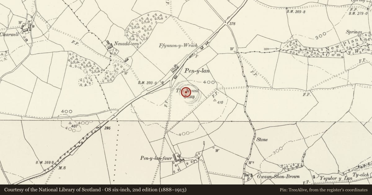
Slide toward Today to fade the historical sheet and see the modern map underneath.
David Rumsey Map Collection, Stanford LibrariesDavid Rumsey Map Collection, Stanford LibrariesDavid Rumsey Map Collection, Stanford LibrariesDavid Rumsey Map Collection, Stanford LibrariesDavid Rumsey Map Collection, Stanford Libraries
5 historical maps cover this location, the earliest the 1636 map "Cornubia : Devonia, Somersetus, Dorcestria, Wiltonia, Glocestria ..." (David Rumsey Map Collection, Stanford Libraries).
Historical maps covering this location
- 1636 · Cornubia : Devonia, Somersetus, Dorcestria, Wiltonia, Glocestria ... (David Rumsey Map Collection, Stanford Libraries)
- 1865 · England and Wales. England No. 6. (David Rumsey Map Collection, Stanford Libraries)
- 1895 · Sheet 11. Ordnance Survey of England and Wales. (David Rumsey Map Collection, Stanford Libraries)
- 1906 · 249 Newport (Hills) (David Rumsey Map Collection, Stanford Libraries)
- 1913 · Sheet 102. Newport. (David Rumsey Map Collection, Stanford Libraries)
Cadw's description
Summary description and reason for designation
The following provides a general description of the Scheduled Ancient Monument.
The monument comprises the remains of a univallate hillfort, which probably dates to the Iron Age period (c. 800 BC - AD 74, the Roman conquest of Wales). The hillfort is situated on the top of a low ridge in a cultivated field. It is a circular earthwork measuring 73m in diameter consisting of a gently sloping bank or scarp around a flat interior. On the N side there is a bank with a small internal height (not more than 0.3m) and an external height of 1.8m. Outside this is a sloping berm, and then a gently sloping scarp 1.5m high. On the E side there is a scarp 1.5m high with a faint ditch outside it. On the S side there is a bank with a small internal height (similar to the north side), and with an external height of 1.5m At the E end there is no external ditch, but at the W end the bank is steeper and there is an external ditch with a depth of 1.2m On the W side there is a very low scarp and no external ditch. The hillfort has been reduced by ploughing.
The monument is of national importance for its potential to enhance our knowledge of later prehistoric defensive organisation and settlement. The site forms an important element within the wider later prehistoric context and within the surrounding landscape. The site is well preserved and retains considerable archaeological potential. There is a strong probability of the presence of evidence relating to chronology, building techniques and functional detail.
The scheduled area comprises the remains described and areas around them within which related evidence may be expected to survive.
Nearby in the register
- Croes-heolyddDomesticunder 1 mi
- The Coach and Horses PHCommercialunder 1 mi
- Croes Carn Einion Roman SiteVillaunder 1 mi
- Wentloog CastleMotteunder 1 mi
Other entries of the same register within about three miles of this one, by straight line.