Cof Cymru: National Historic Assets of Wales · Wales
The Coach and Horses PH
Marshfield, Newport, Wales
A Grade II listed building in Castleton, Marshfield, Newport, designated on 1 March 1963.
The record
- Designation
- Listed building, Grade II
- Broad class
- Commercial
- Date of designation
- 1 March 1963
- Locality
- Castleton
- Community
- Marshfield
- Unitary authority
- Newport
- Country
- Wales
- Coordinates
- 51.54642, -3.07809
- Cadw reference
- 2933
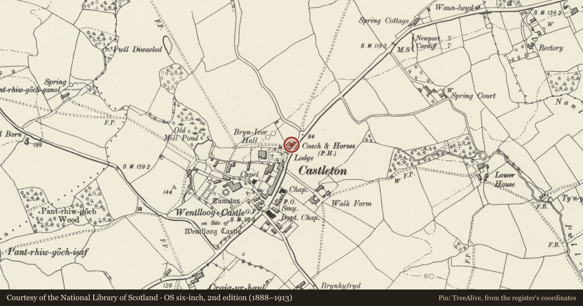
Slide toward Today to fade the historical sheet and see the modern map underneath.
David Rumsey Map Collection, Stanford LibrariesDavid Rumsey Map Collection, Stanford LibrariesDavid Rumsey Map Collection, Stanford LibrariesDavid Rumsey Map Collection, Stanford LibrariesDavid Rumsey Map Collection, Stanford Libraries
5 historical maps cover this location, the earliest the 1636 map "Cornubia : Devonia, Somersetus, Dorcestria, Wiltonia, Glocestria ..." (David Rumsey Map Collection, Stanford Libraries).
Historical maps covering this location
- 1636 · Cornubia : Devonia, Somersetus, Dorcestria, Wiltonia, Glocestria ... (David Rumsey Map Collection, Stanford Libraries)
- 1865 · England and Wales. England No. 6. (David Rumsey Map Collection, Stanford Libraries)
- 1895 · Sheet 11. Ordnance Survey of England and Wales. (David Rumsey Map Collection, Stanford Libraries)
- 1906 · 249 Newport (Hills) (David Rumsey Map Collection, Stanford Libraries)
- 1913 · Sheet 102. Newport. (David Rumsey Map Collection, Stanford Libraries)
Cadw's description
Location
Prominently located on the N side of the A48, aligned on an E/W axis.
Exterior
C18 coaching inn, remaining in use as a public house and with modern alterations. Two storey, rendered elevations, steeply pitched slated roof, gable end chimneys, rebuilt in brick. Front (S) elevation of main range is three windows wide, twelve-paned, horned sashes, with modern shutters, central doorway with semi-circular headed porch. Lower, two storey extension running to the E, probably C19, central doorway with matching porch, now blocked. Three, three-light, fixed windows to the first floor, with shutters. Large lean-to extension to the rear with gabled wing at E end.
Interior
Modernised interior, remaining historic features include large open fire places to each end of bar, exposed rubble walling. The timber lintel above the fireplace in the E cell bears the inscription " TAN DDA AELWYD LAN ALODES LAWEN".
Reason for designation
Listed notwithstanding modern alterations as a prominently sited inn of C18 origin.
Nearby in the register
- Castleton Baptist ChurchReligious, Ritual and Funeraryunder 1 mi
- Wentloog CastleMotteunder 1 mi
- Gelli-ber FarmhouseDomesticunder 1 mi
- Druidstone Standing StoneStanding Stoneunder 1 mi
Other entries of the same register within about three miles of this one, by straight line.