Cof Cymru: National Historic Assets of Wales · Wales
Tump Terrett Castle Mound
Trellech United, Monmouthshire, Wales
A scheduled monument in Trellech United, Monmouthshire, recorded as Motte (Medieval).
The record
- Designation
- Scheduled monument
- Site type
- Motte
- Period
- Medieval
- Community
- Trellech United
- Unitary authority
- Monmouthshire
- Country
- Wales
- Coordinates (centre of the scheduled area)
- 51.74468, -2.72575
- SAM number
- MM016
- Cadw record number
- 1139
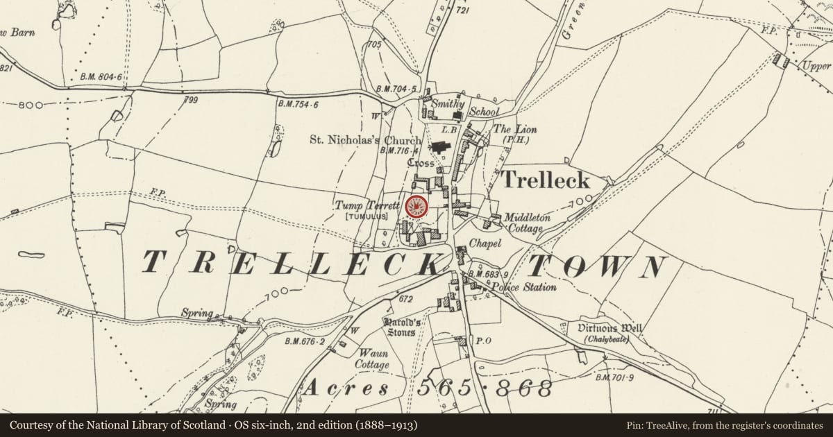
Slide toward Today to fade the historical sheet and see the modern map underneath.
David Rumsey Map Collection, Stanford LibrariesDavid Rumsey Map Collection, Stanford LibrariesDavid Rumsey Map Collection, Stanford LibrariesDavid Rumsey Map Collection, Stanford LibrariesDavid Rumsey Map Collection, Stanford Libraries
5 historical maps cover this location, the earliest the 1636 map "Cornubia : Devonia, Somersetus, Dorcestria, Wiltonia, Glocestria ..." (David Rumsey Map Collection, Stanford Libraries).
Historical maps covering this location
- 1636 · Cornubia : Devonia, Somersetus, Dorcestria, Wiltonia, Glocestria ... (David Rumsey Map Collection, Stanford Libraries)
- 1830 · V.3:11-15:XV.Britisches Reich. A. Kon: England. a. England ab sich: Shire:15-17, 33 (David Rumsey Map Collection, Stanford Libraries)
- 1895 · Sheet 11. Ordnance Survey of England and Wales. (David Rumsey Map Collection, Stanford Libraries)
- 1896 · 233 Monmouth (Hills) (David Rumsey Map Collection, Stanford Libraries)
- 1913 · Sheet 102. Newport. (David Rumsey Map Collection, Stanford Libraries)
Cadw's description
Summary description and reason for designation
The following provides a general summary of the Scheduled Ancient Monument.
The monument comprises the remains of a motte and ditch, dating to the medieval period (c. 1066 -1540 AD). It comprises a large steep-sided mound, 5m high, with a flat summit 14m in diameter. On the S and W sides there is no trace of a ditch, however, on the N side there is a wide, flat bottomed ditch 4m wide and 2.2m deep and on the E side there is a slight trace of a ditch 0.7m deep. Little is known about the history of the castle, however it is recorded as being in existence in 1231.
The monument is of national importance for its potential to enhance our knowledge of medieval defensive practices. The monument is well-preserved and an important relic of the medieval landscape. It retains significant archaeological potential, with a strong probability of the presence of both structural evidence and intact associated deposits.
The scheduled area comprises the remains described and areas around them within which related evidence may be expected to survive.
Nearby in the register
- Barn at Court FarmAgriculture and Subsistenceunder 1 mi
- Court FarmhouseDomesticunder 1 mi
- The Village Green Inn and RestaurantDomesticunder 1 mi
- Outbuilding to the south east of The Village Green Inn and RestaurantDomesticunder 1 mi
Other entries of the same register within about three miles of this one, by straight line.