Cof Cymru: National Historic Assets of Wales · Wales
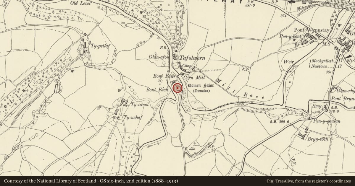
Domen Fawr Castle Mound Tafolwern
Llanbrynmair, Powys, Wales
A scheduled monument in Llanbrynmair, Powys, recorded as Motte (Medieval).
The record
- Designation
- Scheduled monument
- Site type
- Motte
- Period
- Medieval
- Community
- Llanbrynmair
- Unitary authority
- Powys
- Country
- Wales
- Coordinates (centre of the scheduled area)
- 52.61013, -3.63918
- SAM number
- MG065
- Cadw record number
- 2626
Slide toward Today to fade the historical sheet and see the modern map underneath.
David Rumsey Map Collection, Stanford LibrariesDavid Rumsey Map Collection, Stanford LibrariesDavid Rumsey Map Collection, Stanford LibrariesLlyfrgell Genedlaethol Cymru – The National Library of WalesDavid Rumsey Map Collection, Stanford Libraries
5 historical maps cover this location, the earliest the 1795 map "To Sir Watkin Williams-Wynn Bart ... the map of the six counties of North Wales is most humbly inscribed by his obedient humble servant" (Llyfrgell Genedlaethol Cymru – The National Library of Wales).
Historical maps covering this location
- 1795 · To Sir Watkin Williams-Wynn Bart ... the map of the six counties of North Wales is most… (Llyfrgell Genedlaethol Cymru – The National Library of Wales)
- 1830 · V.3:11-15:XV. Britisches Reich. A. Kon: England. b. Frstenthum Wales: Shire: 37-40 (David Rumsey Map Collection, Stanford Libraries)
- 1883 · Watershed map England, Wales 3. (David Rumsey Map Collection, Stanford Libraries)
- 1899 · 150 Dinas-Mawddwy (Hills) (David Rumsey Map Collection, Stanford Libraries)
- 1901 · Sheet 9 and 10. (David Rumsey Map Collection, Stanford Libraries)
Cadw's description
Summary description and reason for designation
The monument comprises the remains of a motte and bailey castle, a military stronghold built during the medieval period. A motte and bailey castle comprises a large conical or pyramidal mound of soil or stone (the motte) surrounded by, or adjacent to, one or more embanked enclosures (the bailey). Both may be surrounded by wet or dry ditches and could be further strengthened with palisades, revetments, and/or a tower on top of the motte. Domen Fawr Tafolwern was the castle of the Welsh prince and poet Owern Cyfeiliog (d. AD1197). The motte stands at the confluence of two rivers, with roads running around its base on the north-west and south-east sides. It stands to a height of c.6m and measures 40m in diamter at its base, and 19m across the summit. Mill Cottage has been built within the bailey enclosure, and the line of the ditch is now obscured.
The monument is of national importance for its potential to enhance our knowledge of medieval defensive organisation. The well-preserved monument forms an important element within the wider medieval context and the structure itself may be expected to contain archaeological information relating to chronology, building techniques and functional detail.
The scheduled area comprises the remains described and areas around them within which related evidence may be expected to survive.
Nearby in the register
- Llanbrynmair Railway Station and houseTransportunder 1 mi
- Milestone at Llanbrynmair BridgeTransportunder 1 mi
- Wynnstay ArmsCommercialunder 1 mi
- Bryn llysDomesticunder 1 mi
Other entries of the same register within about three miles of this one, by straight line.