Cof Cymru: National Historic Assets of Wales · Wales
Bryn llys
Llanbrynmair, Powys, Wales
A Grade II listed building in Llanbrynmair, Powys, designated on 31 January 1997.
The record
- Designation
- Listed building, Grade II
- Broad class
- Domestic
- Date of designation
- 31 January 1997
- Locality
- Llanbrynmair
- Community
- Llanbrynmair
- Unitary authority
- Powys
- Country
- Wales
- Coordinates
- 52.61105, -3.62179
- Cadw reference
- 18116
Slide toward Today to fade the historical sheet and see the modern map underneath.
David Rumsey Map Collection, Stanford LibrariesDavid Rumsey Map Collection, Stanford LibrariesDavid Rumsey Map Collection, Stanford LibrariesLlyfrgell Genedlaethol Cymru – The National Library of WalesDavid Rumsey Map Collection, Stanford Libraries
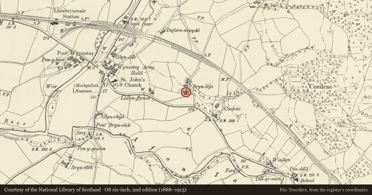
5 historical maps cover this location, the earliest the 1608 map "(13) Cambriae Typus." (David Rumsey Map Collection, Stanford Libraries).
Historical maps covering this location
- 1608 · (13) Cambriae Typus. (David Rumsey Map Collection, Stanford Libraries)
- 1795 · To Sir Watkin Williams-Wynn Bart ... the map of the six counties of North Wales is most… (Llyfrgell Genedlaethol Cymru – The National Library of Wales)
- 1883 · Watershed map England, Wales 3. (David Rumsey Map Collection, Stanford Libraries)
- 1899 · 150 Dinas-Mawddwy (Hills) (David Rumsey Map Collection, Stanford Libraries)
- 1901 · Sheet 9 and 10. (David Rumsey Map Collection, Stanford Libraries)
Cadw's description
Location
The house is located on rising ground, set back from the main A470 and approached through fine iron gates on cast iron stanchions, to a long angled driveway. Further iron gates to the front garden. Ranges of animal houses stand further to the rear.
History
The house was built in the 1880's by the Williams-Wynne family as a gamekeeper's house for the estate.
Exterior
The main facade is of snecked ashlar stone, probably of local origin, with a slate roof. Central stair hall plan with a brick and slated rear staff and service wing on the right side, which has been further extended in the re-entrant angle at the rear. Two storeys, 3 bays, with a cellar under the left end bay. Central glazed door within a wide gabled arch-fronted stone porch. Decorative scrolled bargeboards, and side seats internally. To either side, 12-paned sash windows with thin glazing bars and some crown glass, the openings having heavy slate lintels and sills. Nine-paned windows to the rear. Gable stacks built with buff brick. Wide boarded eaves.
Reason for designation
Listed as a well-preserved example of an estate house of high quality construction, and of a size deemed appropriate to a more senior member of the estate staff.
Nearby in the register
- Coed CaeDomesticunder 1 mi
- Wynnstay ArmsCommercialunder 1 mi
- Milestone at Llanbrynmair BridgeTransportunder 1 mi
- Llanbrynmair Railway Station and houseTransportunder 1 mi
Other entries of the same register within about three miles of this one, by straight line.