Cof Cymru: National Historic Assets of Wales · Wales
Site of St Teilo's Old Parish Church, Llandeilo, Talybont (now removed to St Fagans)
Pontardulais, Swansea, Wales
A scheduled monument in Pontardulais, Swansea, recorded as Church (Medieval).
The record
- Designation
- Scheduled monument
- Site type
- Church
- Period
- Medieval
- Date of designation
- 24 June 1980
- Community
- Pontardulais
- Unitary authority
- Swansea
- Country
- Wales
- Coordinates (centre of the scheduled area)
- 51.70790, -4.04976
- SAM number
- GM415
- Cadw record number
- 3569
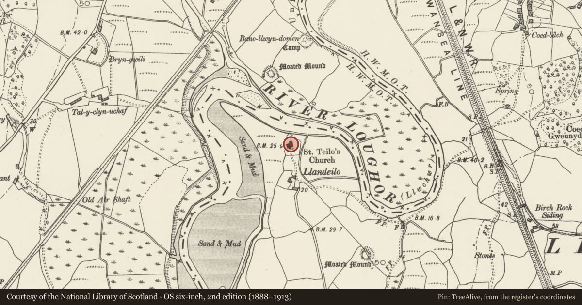
Slide toward Today to fade the historical sheet and see the modern map underneath.
David Rumsey Map Collection, Stanford LibrariesDavid Rumsey Map Collection, Stanford LibrariesDavid Rumsey Map Collection, Stanford LibrariesDavid Rumsey Map Collection, Stanford LibrariesDavid Rumsey Map Collection, Stanford Libraries
5 historical maps cover this location, the earliest the 1636 map "Cornubia : Devonia, Somersetus, Dorcestria, Wiltonia, Glocestria ..." (David Rumsey Map Collection, Stanford Libraries).
Historical maps covering this location
- 1636 · Cornubia : Devonia, Somersetus, Dorcestria, Wiltonia, Glocestria ... (David Rumsey Map Collection, Stanford Libraries)
- 1637 · The fourth table of England. Cornub. Devonia, Somerset etc. (David Rumsey Map Collection, Stanford Libraries)
- 1891 · Sheet 10. Ordnance Survey of England and Wales. . (David Rumsey Map Collection, Stanford Libraries)
- 1898 · 230 Ammanford (Hills) (David Rumsey Map Collection, Stanford Libraries)
- 1920 · Sheet 100. Llanelly. (David Rumsey Map Collection, Stanford Libraries)
Cadw's description
Summary description and reason for designation
The following provides a general description of the Scheduled Ancient Monument.
The monument consists of the remains of a medieval church. Situated on a small rise by the banks of the tidal Afon Loughor, the church served the parish of Llandeilo Tal-y-bont. Only the wall foundations of the church and churchyard now remain, the church itself was removed to St Fagan's Museum in the 1980s. The foundations of the church show a nave, south aisle, north chapel and south porch. The churchyard is enclosed by a stone wall.
The monument is of national importance for its potential to enhance our knowledge of medieval ecclesiastical organisation. The monument forms an important element within the wider medieval context and the structure itself may be expected to contain archaeological information in regard to chronology, building techniques and functional detail.
The scheduled area comprises the remains described and areas around them within which related evidence may be expected to survive.
Nearby in the register
- Hendy Castle MoundMotteunder 1 mi
- Hendy EarthworkEnclosureunder 1 mi
- Llandeilo Castle MoundMotteunder 1 mi
- Viaduct at Morlais Junction East (partly in Llanedi community)Transportunder 1 mi
Other entries of the same register within about three miles of this one, by straight line.