Cof Cymru: National Historic Assets of Wales · Wales
Waun Llanfair barrow
Llanfairfechan, Conwy, Wales
A scheduled monument in Llanfairfechan, Conwy, recorded as Round Barrow (Prehistoric).
The record
- Designation
- Scheduled monument
- Site type
- Round Barrow
- Period
- Prehistoric
- Date of designation
- 10 May 2004
- Community
- Llanfairfechan
- Unitary authority
- Conwy
- Country
- Wales
- Coordinates (centre of the scheduled area)
- 53.24831, -3.94200
- SAM number
- CN351
- Cadw record number
- 4068
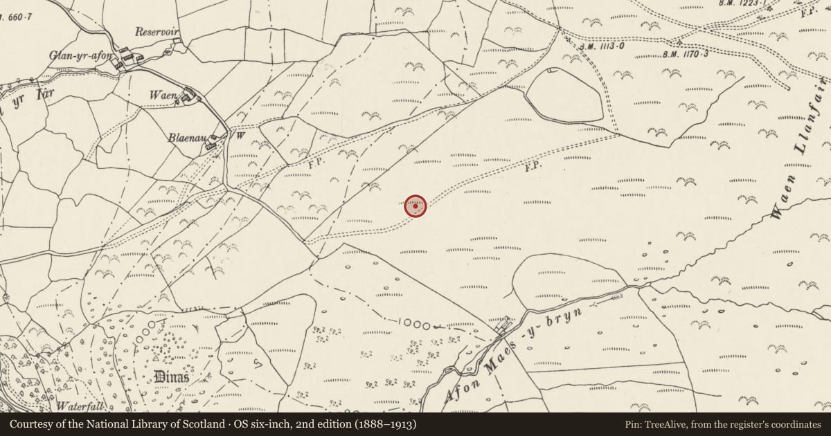
Slide toward Today to fade the historical sheet and see the modern map underneath.
David Rumsey Map Collection, Stanford LibrariesDavid Rumsey Map Collection, Stanford LibrariesDavid Rumsey Map Collection, Stanford LibrariesDavid Rumsey Map Collection, Stanford LibrariesDavid Rumsey Map Collection, Stanford Libraries
5 historical maps cover this location, the earliest the 1883 map "Watershed map England, Wales 3." (David Rumsey Map Collection, Stanford Libraries).
Historical maps covering this location
- 1883 · Watershed map England, Wales 3. (David Rumsey Map Collection, Stanford Libraries)
- 1896 · Sheet 7. Ordnance Survey of England and Wales. (David Rumsey Map Collection, Stanford Libraries)
- 1899 · 106 Bangor (Outline) (David Rumsey Map Collection, Stanford Libraries)
- 1899 · 106 Bangor (Hills) (David Rumsey Map Collection, Stanford Libraries)
- 1901 · Sheet 9 and 10. (David Rumsey Map Collection, Stanford Libraries)
Cadw's description
Summary description and reason for designation
The following provides a general description of the Scheduled Ancient Monument.
The monument comprises the remains of a fine round barrow, probably dating to the Bronze Age (c.2300 BC - 800 BC) and situated within well-drained open moorland on the summit of a prominent rounded ridge at the NW-facing edge of Waun Llanfair. The grass-covered barrow is circular on plan and measures about 7m in diameter and up to 0.6m in height; a turf-halo surrounds the barrow, visible as a shallow ditch up to 1.5m in width. The site boasts excellent views of the Lavan Sands and Conwy Bay.
The monument is of national importance as an important relic of a prehistoric funerary and ritual landscape and for its potential to enhance our knowledge of prehistoric burial and ritual. The monument retains significant archaeological potential, with a strong probability of the presence of both intact burial or ritual deposits and environmental and structural evidence, including traces of a buried prehistoric land surface underneath.
The area to be scheduled comprises the remains described and an area around them within which related evidence may be expected to survive. It is circular and measures 17m in diameter.
Nearby in the register
- Dinas CampHillfortunder 1 mi
- Glan-yr-Afon FarmhouseDomesticunder 1 mi
- Hut Circles at Clip yr OrseddHut Circle Settlementunder 1 mi
- The LodgeDomesticunder 1 mi
Other entries of the same register within about three miles of this one, by straight line.