Cof Cymru: National Historic Assets of Wales · Wales
Caerau Ancient Village
Llanllyfni, Gwynedd, Wales
A scheduled monument in Llanllyfni, Gwynedd, recorded as Enclosed hut circle (Prehistoric).
The record
- Designation
- Scheduled monument
- Site type
- Enclosed hut circle
- Period
- Prehistoric
- Community
- Llanllyfni
- Unitary authority
- Gwynedd
- Country
- Wales
- Coordinates (centre of the scheduled area)
- 53.01580, -4.28280
- SAM number
- CN067
- Cadw record number
- 2429
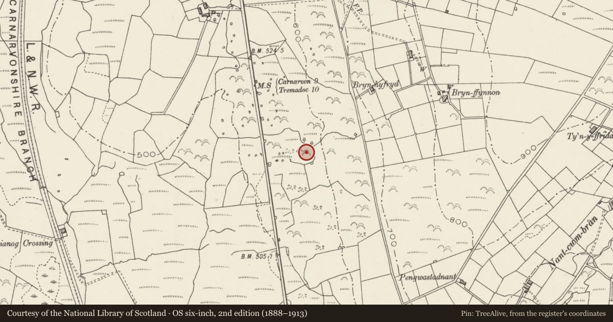
Slide toward Today to fade the historical sheet and see the modern map underneath.
David Rumsey Map Collection, Stanford LibrariesDavid Rumsey Map Collection, Stanford LibrariesDavid Rumsey Map Collection, Stanford LibrariesDavid Rumsey Map Collection, Stanford LibrariesLlyfrgell Genedlaethol Cymru – The National Library of Wales
5 historical maps cover this location, the earliest the 1795 map "To Sir Watkin Williams-Wynn Bart ... the map of the six counties of North Wales is most humbly inscribed by his obedient humble servant" (Llyfrgell Genedlaethol Cymru – The National Library of Wales).
Historical maps covering this location
- 1795 · To Sir Watkin Williams-Wynn Bart ... the map of the six counties of North Wales is most… (Llyfrgell Genedlaethol Cymru – The National Library of Wales)
- 1883 · Watershed map England, Wales 3. (David Rumsey Map Collection, Stanford Libraries)
- 1896 · Sheet 7. Ordnance Survey of England and Wales. (David Rumsey Map Collection, Stanford Libraries)
- 1899 · 118 Nevin (Hills) (David Rumsey Map Collection, Stanford Libraries)
- 1901 · Sheet 9 and 10. (David Rumsey Map Collection, Stanford Libraries)
Cadw's description
Summary description and reason for designation
The following provides a general description of the Scheduled Monument.
The monument comprises the remains of an enclosed Iron Age settlement of multiple hut circles and early fields on the lower slopes of Mynydd Craig Goch. The scheduled area includes two of the settlement sites and a part of the associated fields. The settlement may have been enclosed but it was probably not a defensive site, whilst long views especially to the west are important the significant views would have been medium and short over the fields that would have been farmed from the settlement. These are also primarily to the west.
The monument is of national importance for its potential to enhance our knowledge of prehistoric settlement practices. It is an important relic of the prehistoric landscape and retains significant archaeological potential. There is a strong probability of the presence of environmental and structural evidence, including preserved internal and external floor levels.
The scheduled area comprises the remains described and areas around them within which related evidence may be expected to survive.
Nearby in the register
- MilestoneTransportunder 1 mi
- ParcDomesticunder 1 mi
- Independent ChapelReligious, Ritual and Funeraryunder 1 mi
- Ty CapelDomesticunder 1 mi
Other entries of the same register within about three miles of this one, by straight line.