Cof Cymru: National Historic Assets of Wales · Wales
Sundial in Clynnog Fawr Churchyard
Clynnog, Gwynedd, Wales
A scheduled monument in Clynnog, Gwynedd, recorded as Sundial (Early Medieval).
The record
- Designation
- Scheduled monument
- Site type
- Sundial
- Period
- Early Medieval
- Community
- Clynnog
- Unitary authority
- Gwynedd
- Country
- Wales
- Coordinates (centre of the scheduled area)
- 53.02078, -4.36561
- SAM number
- CN062
- Cadw record number
- 563
Slide toward Today to fade the historical sheet and see the modern map underneath.
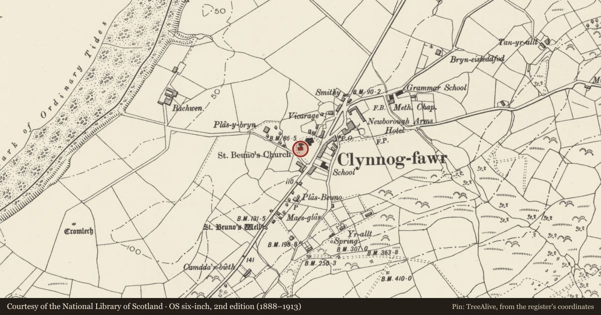
David Rumsey Map Collection, Stanford LibrariesDavid Rumsey Map Collection, Stanford LibrariesDavid Rumsey Map Collection, Stanford LibrariesDavid Rumsey Map Collection, Stanford LibrariesLlyfrgell Genedlaethol Cymru – The National Library of Wales
5 historical maps cover this location, the earliest the 1795 map "To Sir Watkin Williams-Wynn Bart ... the map of the six counties of North Wales is most humbly inscribed by his obedient humble servant" (Llyfrgell Genedlaethol Cymru – The National Library of Wales).
Historical maps covering this location
- 1795 · To Sir Watkin Williams-Wynn Bart ... the map of the six counties of North Wales is most… (Llyfrgell Genedlaethol Cymru – The National Library of Wales)
- 1883 · Watershed map England, Wales 3. (David Rumsey Map Collection, Stanford Libraries)
- 1896 · Sheet 7. Ordnance Survey of England and Wales. (David Rumsey Map Collection, Stanford Libraries)
- 1899 · 118 Nevin (Hills) (David Rumsey Map Collection, Stanford Libraries)
- 1901 · Sheet 9 and 10. (David Rumsey Map Collection, Stanford Libraries)
Cadw's description
Summary description and reason for designation
The following provides a general description of the Scheduled Monument.
A sundial previously at Llyn y Gele farm, but now standing in Clynnog Fawr churchyard, at the SW corner of St Beuno's Chapel. Described as being of the "Irish type" and dating to the 10th to early 12th century.
A vertical dial on a stone shaft of local granite, standing 2m above the ground, about 0.55m wide and from 0.11m to 0.13m thick. It is pierced near the top with a central style-hole (for the gnomon) and incised with diameter and lower semicircle described from that hole, the outer segments projecting slightly from the sides of the shaft to a diameter of 0.33m; the semicircle divided into four octants by incised rays each ending in a short bar within a small ring touching the curve from the inside. The hole was bored from both sides, to judge from the neck remaining at the middle, and would take a gnomon bar about an inch thick.
The monument is of national importance for its potential to enhance our knowledge of the early medieval period.
The scheduled area comprises the remains described and areas around them within which related evidence may be expected to survive.
Nearby in the register
- Sundial in the churchyard of the Church of St BeunoReligious, Ritual and Funeraryunder 1 mi
- Church of St Beuno, with attached Chapel of St BeunoReligious, Ritual and Funeraryunder 1 mi
- BodfasarnDomesticunder 1 mi
- Tomb of Eben FarddReligious, Ritual and Funeraryunder 1 mi
Other entries of the same register within about three miles of this one, by straight line.