Cof Cymru: National Historic Assets of Wales · Wales
Sundial in the churchyard of the Church of St Beuno
Clynnog, Gwynedd, Wales
A Grade II listed building in Clynnog-fawr, Caernarfon, Clynnog, Gwynedd, designated on 15 September 1999.
The record
- Designation
- Listed building, Grade II
- Broad class
- Religious, Ritual and Funerary
- Date of designation
- 15 September 1999
- Locality
- Clynnog-fawr
- Town
- Caernarfon
- Community
- Clynnog
- Unitary authority
- Gwynedd
- Country
- Wales
- Coordinates
- 53.02077, -4.36549
- Cadw reference
- 22350
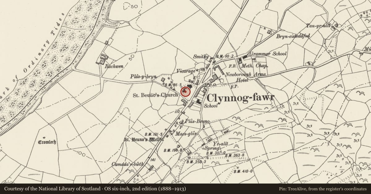
Slide toward Today to fade the historical sheet and see the modern map underneath.
David Rumsey Map Collection, Stanford LibrariesDavid Rumsey Map Collection, Stanford LibrariesDavid Rumsey Map Collection, Stanford LibrariesDavid Rumsey Map Collection, Stanford LibrariesLlyfrgell Genedlaethol Cymru – The National Library of Wales
5 historical maps cover this location, the earliest the 1795 map "To Sir Watkin Williams-Wynn Bart ... the map of the six counties of North Wales is most humbly inscribed by his obedient humble servant" (Llyfrgell Genedlaethol Cymru – The National Library of Wales).
Historical maps covering this location
- 1795 · To Sir Watkin Williams-Wynn Bart ... the map of the six counties of North Wales is most… (Llyfrgell Genedlaethol Cymru – The National Library of Wales)
- 1883 · Watershed map England, Wales 3. (David Rumsey Map Collection, Stanford Libraries)
- 1896 · Sheet 7. Ordnance Survey of England and Wales. (David Rumsey Map Collection, Stanford Libraries)
- 1899 · 118 Nevin (Hills) (David Rumsey Map Collection, Stanford Libraries)
- 1901 · Sheet 9 and 10. (David Rumsey Map Collection, Stanford Libraries)
Cadw's description
Location
The sundial now stands in the churchyard approximately 3m from the SW corner of the Chapel of St Beuno.
History
The sundial is Irish Celtic type of slab-dial forming a cross at its head, and is probably of the C10-early C12.
Exterior
The cross consists of a vertical slab of granite, 500mm wide and 125mm thick and approximately 2m high (reduced by c30cm) with a wheel cross head, drilled through to take a gnomon. Eight radial lines to the lightly inscribed hour circle, which is set out on the octaval system used in Anglo-Saxon times, where the 24 hours are marked as 8 'tides'. The reverse is plain.
Reason for designation
Included as an important and well preserved sundial cross of western Celtic pattern, of a type also known in Ireland, but thought to be unique in Wales, and probably still standing in its original location on a major religious site.
Nearby in the register
- Sundial in Clynnog Fawr ChurchyardSundialunder 1 mi
- Church of St Beuno, with attached Chapel of St BeunoReligious, Ritual and Funeraryunder 1 mi
- BodfasarnDomesticunder 1 mi
- Tomb of Eben FarddReligious, Ritual and Funeraryunder 1 mi
Other entries of the same register within about three miles of this one, by straight line.