Cof Cymru: National Historic Assets of Wales · Wales
Garn Boduan
Buan, Gwynedd, Wales
A scheduled monument in Buan, Gwynedd, recorded as Hillfort (Prehistoric).
The record
- Designation
- Scheduled monument
- Site type
- Hillfort
- Period
- Prehistoric
- Community
- Buan
- Unitary authority
- Gwynedd
- Country
- Wales
- Coordinates (centre of the scheduled area)
- 52.92412, -4.51154
- SAM number
- CN009
- Cadw record number
- 3156
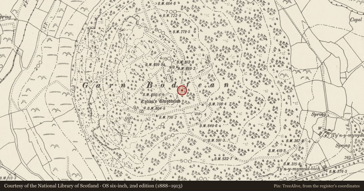
Slide toward Today to fade the historical sheet and see the modern map underneath.
David Rumsey Map Collection, Stanford LibrariesDavid Rumsey Map Collection, Stanford LibrariesDavid Rumsey Map Collection, Stanford LibrariesDavid Rumsey Map Collection, Stanford LibrariesDavid Rumsey Map Collection, Stanford Libraries
5 historical maps cover this location, the earliest the 1830 map "V.3:11-15:XV. Britisches Reich. A. Kon: England. b. Frstenthum Wales: Shire: 37-40" (David Rumsey Map Collection, Stanford Libraries).
Historical maps covering this location
- 1830 · V.3:11-15:XV. Britisches Reich. A. Kon: England. b. Frstenthum Wales: Shire: 37-40 (David Rumsey Map Collection, Stanford Libraries)
- 1883 · Watershed map England, Wales 3. (David Rumsey Map Collection, Stanford Libraries)
- 1896 · Sheet 7. Ordnance Survey of England and Wales. (David Rumsey Map Collection, Stanford Libraries)
- 1899 · 118 Nevin (Hills) (David Rumsey Map Collection, Stanford Libraries)
- 1901 · Sheet 9 and 10. (David Rumsey Map Collection, Stanford Libraries)
Cadw's description
Summary description and reason for designation
The following provides a general description of the Scheduled Monument.
A hillfort of at least three phases of construction, with an impressive number of round huts occupying the interior. Also scheduled are two settlements, one on the E slopes and the other on the S slopes of Garn Boduan. The slopes of the hill have been afforested, and although a fire on the summit has ensured that there are few live trees within the area of the hillfort, the two settlements are both within the plantation.
The monument is of national importance for its potential to enhance our knowledge of Prehistoric settlement and defence. It retains significant archaeological potential, with a strong probability of the presence of associated archaeological features and deposits. The structures themselves may be expected to contain archaeological information concerning chronology and building techniques.
The scheduled area comprises the remains described and areas around them within which related evidence may be expected to survive.
Nearby in the register
- Tan-y-fronDomesticunder 1 mi
- Tan-y-fronDomesticunder 1 mi
- The Cock-loftDomesticunder 1 mi
- MilestoneTransportunder 1 mi
Other entries of the same register within about three miles of this one, by straight line.