Cof Cymru: National Historic Assets of Wales · Wales
Tan-y-fron
Buan, Gwynedd, Wales
A Grade II listed building in Boduan, Pwllheli, Buan, Gwynedd, designated on 15 July 1998.
The record
- Designation
- Listed building, Grade II
- Broad class
- Domestic
- Date of designation
- 15 July 1998
- Locality
- Boduan
- Town
- Pwllheli
- Community
- Buan
- Unitary authority
- Gwynedd
- Country
- Wales
- Coordinates
- 52.91834, -4.51659
- Cadw reference
- 20122
Slide toward Today to fade the historical sheet and see the modern map underneath.
David Rumsey Map Collection, Stanford LibrariesDavid Rumsey Map Collection, Stanford LibrariesDavid Rumsey Map Collection, Stanford LibrariesDavid Rumsey Map Collection, Stanford LibrariesDavid Rumsey Map Collection, Stanford Libraries
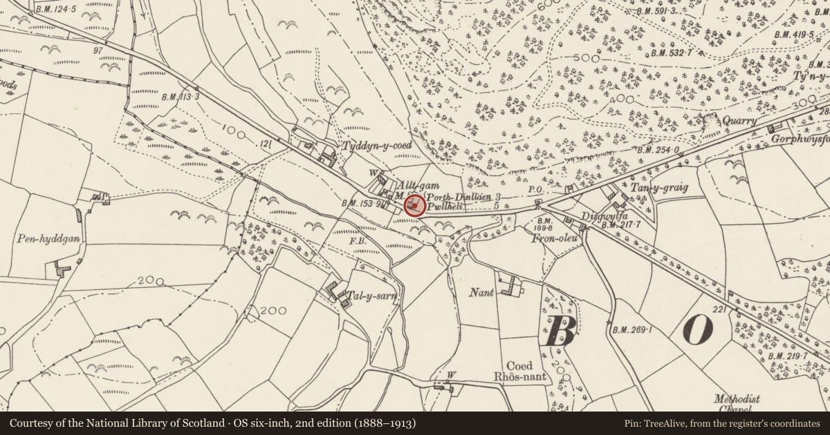
5 historical maps cover this location, the earliest the 1830 map "V.3:11-15:XV. Britisches Reich. A. Kon: England. b. Frstenthum Wales: Shire: 37-40" (David Rumsey Map Collection, Stanford Libraries).
Historical maps covering this location
- 1830 · V.3:11-15:XV. Britisches Reich. A. Kon: England. b. Frstenthum Wales: Shire: 37-40 (David Rumsey Map Collection, Stanford Libraries)
- 1883 · Watershed map England, Wales 3. (David Rumsey Map Collection, Stanford Libraries)
- 1896 · Sheet 7. Ordnance Survey of England and Wales. (David Rumsey Map Collection, Stanford Libraries)
- 1899 · 118 Nevin (Hills) (David Rumsey Map Collection, Stanford Libraries)
- 1901 · Sheet 9 and 10. (David Rumsey Map Collection, Stanford Libraries)
Cadw's description
Location
Situated on the NE side of the A497, about 350m W of junction with B4354.
History
Part of row of three 2-storey, 2-window estate cottages built c1840 by the Newborough Estate at Boduan, as shown on title deeds. No 1 is the former Nos 1 and 2, now linked internally to form a single dwelling. As built Nos 2 and 3 were a mirrored pair with adjacent doors, no 1 was attached at E end.
Exterior
Two cottages, now one, but part of row of three. Rubble granite walls, large stone lintels and small-slated roof. Two-storey, two-window elevations of 12-pane hornless sashes with ledged doors and overlights (6-pane overlight on right cottage). Right end pebbledashed stacks each with two yellow clay crested pots. One cottage has stone outshut to rear.
Interior
Two single unit plan cottages. Cottage No 1 - cast-iron range in rear outshut. Cottage No 2 has small boarded partition to right of entry with stick-baluster stair ahead. Open-beamed ceilings. Main room has cast-iron range on inner wall marked 'W Davies Pwllheli'. High mantel-shelf and side cupboards.
Reason for designation
Included as part of a well preserved row of late Georgian style estate cottages. Group value with No 3 adjacent and also with Croglofft Cottage, Tan-y-fron.
Nearby in the register
- Tan-y-fronDomesticunder 1 mi
- MilestoneTransportunder 1 mi
- The Cock-loftDomesticunder 1 mi
- Nant FarmDomesticunder 1 mi
Other entries of the same register within about three miles of this one, by straight line.