Cof Cymru: National Historic Assets of Wales · Wales
Penlan-Noeth, Round Barrow 230m NNW of
Llanarth, Ceredigion, Wales
A scheduled monument in Llanarth, Ceredigion, recorded as Round Barrow (Prehistoric).
The record
- Designation
- Scheduled monument
- Site type
- Round Barrow
- Period
- Prehistoric
- Date of designation
- 6 November 2006
- Community
- Llanarth
- Unitary authority
- Ceredigion
- Country
- Wales
- Coordinates (centre of the scheduled area)
- 52.14896, -4.23365
- SAM number
- CD221
- Cadw record number
- 1205
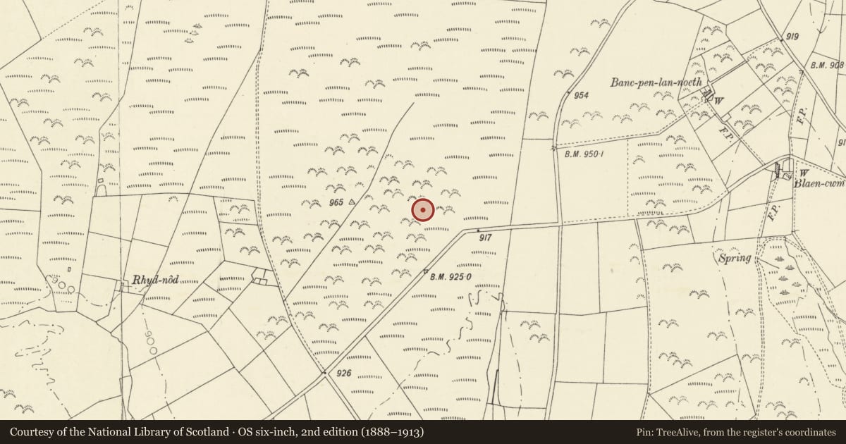
Slide toward Today to fade the historical sheet and see the modern map underneath.
David Rumsey Map Collection, Stanford LibrariesDavid Rumsey Map Collection, Stanford LibrariesDavid Rumsey Map Collection, Stanford LibrariesDavid Rumsey Map Collection, Stanford LibrariesDavid Rumsey Map Collection, Stanford Libraries
5 historical maps cover this location, the earliest the 1608 map "(13) Cambriae Typus." (David Rumsey Map Collection, Stanford Libraries).
Historical maps covering this location
- 1608 · (13) Cambriae Typus. (David Rumsey Map Collection, Stanford Libraries)
- 1830 · V.3:11-15:XV. Britisches Reich. A. Kon: England. b. Frstenthum Wales: Shire: 37-40 (David Rumsey Map Collection, Stanford Libraries)
- 1899 · 194 Llangranog (Hills) (David Rumsey Map Collection, Stanford Libraries)
- 1901 · Sheet 14. (David Rumsey Map Collection, Stanford Libraries)
- 1919 · Sheet 78. Lampeter. (David Rumsey Map Collection, Stanford Libraries)
Cadw's description
Summary description and reason for designation
The following provides a general description of the Scheduled Monument.
The monument comprises the remains of an earth and stone built round barrow, probably dating to the Bronze Age (c. 2300 - 800 BC). It is located midway down a gentle SE-facing slope in an arable field cultivated for corn. The barrow is circular in shape on plan and measures c. 22m in diameter and a maximum of 0.6m in height. The mound has been lowered and spread by ploughing. Despite this disturbance, the bulk of the barrow remains intact and well defined.
The monument is of national importance for its potential to enhance our knowledge of prehistoric burial and ritual practices. The feature is an important relic of a prehistoric funerary and ritual landscape and retains significant archaeological potential. There is a strong probability of the presence of both intact burial or ritual deposits, together with environmental and structural evidence.
The scheduled area comprises the remains described and an area around within which related evidence may be expected to survive. The scheduled area is circular in shape on plan and measures 30m in diameter.
Nearby in the register
- Castell 270m E of Moeddyn-FachPromontory Fort - inlandunder 1 mi
- Castell MoeddynHillfortunder 1 mi
- Whilgarn Ring CairnRing Cairn2 mi
- Capel Troedyrhiw (Independent)Religious, Ritual and Funerary2 mi
Other entries of the same register within about three miles of this one, by straight line.