Cof Cymru: National Historic Assets of Wales · Wales
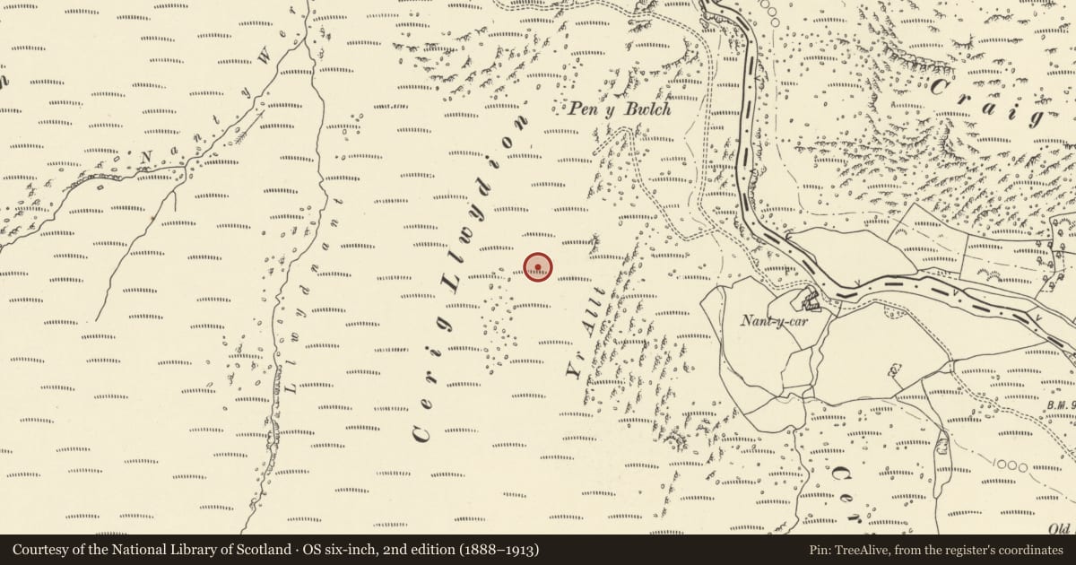
Cerrig Llwydion Deserted Rural Settlement
Llanwrthwl, Powys, Wales
A scheduled monument in Llanwrthwl, Powys, recorded as Deserted Rural Settlement (Post Medieval/Modern).
The record
- Designation
- Scheduled monument
- Site type
- Deserted Rural Settlement
- Period
- Post Medieval/Modern
- Date of designation
- 15 December 2000
- Community
- Llanwrthwl
- Unitary authority
- Powys
- Country
- Wales
- Coordinates (centre of the scheduled area)
- 52.24738, -3.63992
- SAM number
- BR287
- Cadw record number
- 129
Slide toward Today to fade the historical sheet and see the modern map underneath.
David Rumsey Map Collection, Stanford LibrariesDavid Rumsey Map Collection, Stanford LibrariesDavid Rumsey Map Collection, Stanford LibrariesBayerische Staatsbibliothek, MunichDavid Rumsey Map Collection, Stanford Libraries
5 historical maps cover this location, the earliest the 1588 map "Ortelius, Abraham: Theatro De La Tierra Universal. 0" (Bayerische Staatsbibliothek, Munich).
Historical maps covering this location
- 1588 · Ortelius, Abraham: Theatro De La Tierra Universal. 0 (Bayerische Staatsbibliothek, Munich)
- 1608 · (13) Cambriae Typus. (David Rumsey Map Collection, Stanford Libraries)
- 1883 · Watershed map England, Wales 3. (David Rumsey Map Collection, Stanford Libraries)
- 1898 · 179 Rhyader (Hills) (David Rumsey Map Collection, Stanford Libraries)
- 1901 · Sheet 14. (David Rumsey Map Collection, Stanford Libraries)
Cadw's description
Summary description and reason for designation
The following provides a general description of the Scheduled Ancient Monument.
The monument consists of the remains of a deserted rural settlement, probably dating to the medieval or post-medieval period and is spread across the north-east facing slope of Cerrig Llwydion. There are six buildings, some of which stand up to 1m high, whilst others are visible as low earth bank foundation walls.
The monument is of national importance for its potential to enhance our knowledge of medieval or post-medieval settlement organisation. It retains significant archaeological potential, with a strong probability of the presence of associated archaeological features and deposits. A deserted rural settlement may be part of a larger cluster of monuments and their importance can further enhanced by their group value.
The scheduled area comprises the remains described and areas around them within which related evidence may be expected to survive.
Nearby in the register
- Standing Stone above Craig RhiwnantStanding Stoneunder 1 mi
- Prehistoric Enclosure & Settlement Site on Craig y LlysiauEnclosureunder 1 mi
- Nant-y-Car South Lead MineLead Mineunder 1 mi
- Dalrhiw Lead MineLead Mineunder 1 mi
Other entries of the same register within about three miles of this one, by straight line.