Cof Cymru: National Historic Assets of Wales · Wales
Llandefaelog Fach Motte
Honddu Isaf, Powys, Wales
A scheduled monument in Honddu Isaf, Powys, recorded as Motte (Medieval).
The record
- Designation
- Scheduled monument
- Site type
- Motte
- Period
- Medieval
- Date of designation
- 10 October 1988
- Community
- Honddu Isaf
- Unitary authority
- Powys
- Country
- Wales
- Coordinates (centre of the scheduled area)
- 51.98121, -3.40928
- SAM number
- BR191
- Cadw record number
- 1802
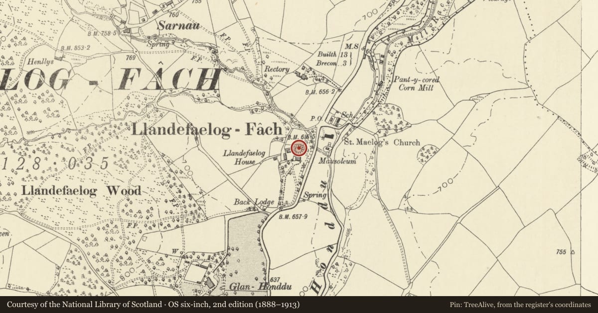
Slide toward Today to fade the historical sheet and see the modern map underneath.
David Rumsey Map Collection, Stanford LibrariesDavid Rumsey Map Collection, Stanford LibrariesDavid Rumsey Map Collection, Stanford LibrariesDavid Rumsey Map Collection, Stanford LibrariesDavid Rumsey Map Collection, Stanford Libraries
5 historical maps cover this location, the earliest the 1608 map "(13) Cambriae Typus." (David Rumsey Map Collection, Stanford Libraries).
Historical maps covering this location
- 1608 · (13) Cambriae Typus. (David Rumsey Map Collection, Stanford Libraries)
- 1636 · Cornubia : Devonia, Somersetus, Dorcestria, Wiltonia, Glocestria ... (David Rumsey Map Collection, Stanford Libraries)
- 1856 · 42. Brecon. (David Rumsey Map Collection, Stanford Libraries)
- 1898 · 213 Brecon (Hills) (David Rumsey Map Collection, Stanford Libraries)
- 1901 · Sheet 14. (David Rumsey Map Collection, Stanford Libraries)
Cadw's description
Summary description and reason for designation
The following provides a general description of the Scheduled Ancient Monument.
The monument comprises the remains of a motte, dating to the medieval period (c. 1066 -1540 AD). The motte is circular in plan and around 5m in height with gentle slopes on all sides except for the S where the mound has been truncated by the construction of a house. The summit is flat, measuring 10m E/W by 12m N/S. There is no evidence of a ditch or a bailey, although the base of the mound has been terraced by a garden path and the surrounding area has been landscaped.
The monument is of national importance for its potential to enhance our knowledge of medieval defensive practices. The monument is well-preserved and an important relic of the medieval landscape. It retains significant archaeological potential, with a strong probability of the presence of both structural evidence and intact associated deposits.
The scheduled area comprises the remains described and areas around them within which related evidence may be expected to survive.
Nearby in the register
- Llandefaelog HouseDomesticunder 1 mi
- Lychgate to Church of Saint MaelogReligious, Ritual and Funeraryunder 1 mi
- Mausoleum to Watkins family of PenoyreReligious, Ritual and Funeraryunder 1 mi
- Churchyard cross and Dickinson vaultReligious, Ritual and Funeraryunder 1 mi
Other entries of the same register within about three miles of this one, by straight line.