Cof Cymru: National Historic Assets of Wales · Wales
Lychgate to Church of Saint Maelog
Honddu Isaf, Powys, Wales
A Grade II listed building in Llandyfaelog Fach, Brecon, Honddu Isaf, Powys, designated on 16 February 2005.
The record
- Designation
- Listed building, Grade II
- Broad class
- Religious, Ritual and Funerary
- Date of designation
- 16 February 2005
- Locality
- Llandyfaelog Fach
- Town
- Brecon
- Community
- Honddu Isaf
- Unitary authority
- Powys
- Country
- Wales
- Coordinates
- 51.98155, -3.40840
- Cadw reference
- 83682
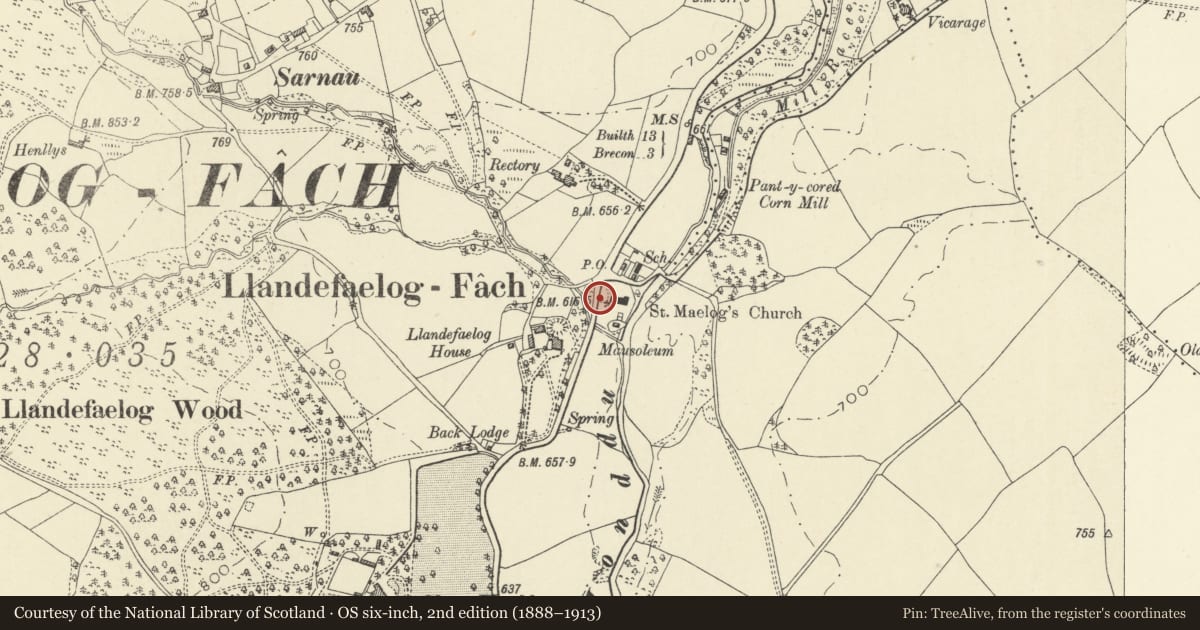
Slide toward Today to fade the historical sheet and see the modern map underneath.
David Rumsey Map Collection, Stanford LibrariesDavid Rumsey Map Collection, Stanford LibrariesDavid Rumsey Map Collection, Stanford LibrariesDavid Rumsey Map Collection, Stanford LibrariesDavid Rumsey Map Collection, Stanford Libraries
5 historical maps cover this location, the earliest the 1608 map "(13) Cambriae Typus." (David Rumsey Map Collection, Stanford Libraries).
Historical maps covering this location
- 1608 · (13) Cambriae Typus. (David Rumsey Map Collection, Stanford Libraries)
- 1636 · Cornubia : Devonia, Somersetus, Dorcestria, Wiltonia, Glocestria ... (David Rumsey Map Collection, Stanford Libraries)
- 1856 · 42. Brecon. (David Rumsey Map Collection, Stanford Libraries)
- 1898 · 213 Brecon (Hills) (David Rumsey Map Collection, Stanford Libraries)
- 1901 · Sheet 14. (David Rumsey Map Collection, Stanford Libraries)
Cadw's description
Location
On the W side of the churchyard in the centre of Llandefaelog Fach.
History
Lychgate of 1897 by F. R. Kempson of Cardiff erected by William Powell of Struet House, Brecon, to his son Edward Powell 1858-94. It was made by John Griffiths of Brecon.
Exterior
Lychgate, oak, on side walls of rockfaced grey rubble stone with red sandstone chamfered coping and top to high plinth. Dedication panel on N wall. Roof gabled to sides, of plain tiles with crested ridge tiles. Three posts each side, outer ones with curved braces up to lintels, and small outer shaped blocks. Sides each have two pointed openings with ogee cusped bracing, tie-beam, king-post and diagonal struts in gable. Double iron gates with double lower, middle and top rails, spearheads with scrolls, and diagonal strengthening bars.
Reason for designation
Included for its special interest as a well-designed late C19 lychgate giving access to a notable church and churchyard.
Nearby in the register
- Church of Saint MaelogReligious, Ritual and Funeraryunder 1 mi
- Cross-Slab in ChurchCross-marked stoneunder 1 mi
- Churchyard cross and Dickinson vaultReligious, Ritual and Funeraryunder 1 mi
- Mausoleum to Watkins family of PenoyreReligious, Ritual and Funeraryunder 1 mi
Other entries of the same register within about three miles of this one, by straight line.