Cof Cymru: National Historic Assets of Wales · Wales
Churchyard Cross, St Issau's Church
The Vale of Grwyney, Powys, Wales
A scheduled monument in The Vale of Grwyney, Powys, recorded as Cross (Medieval).
The record
- Designation
- Scheduled monument
- Site type
- Cross
- Period
- Medieval
- Community
- The Vale of Grwyney
- Unitary authority
- Powys
- Country
- Wales
- Coordinates (centre of the scheduled area)
- 51.89571, -3.04929
- SAM number
- BR172
- Cadw record number
- 1794
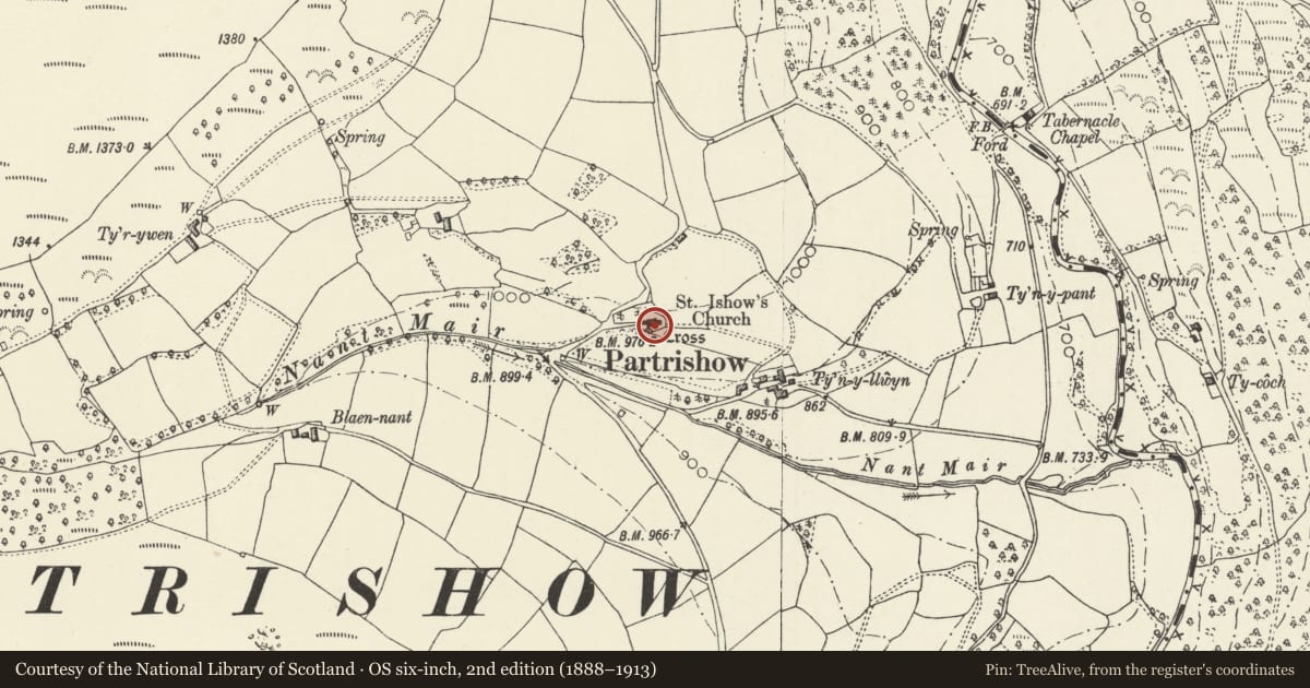
Slide toward Today to fade the historical sheet and see the modern map underneath.
David Rumsey Map Collection, Stanford LibrariesDavid Rumsey Map Collection, Stanford LibrariesDavid Rumsey Map Collection, Stanford LibrariesDavid Rumsey Map Collection, Stanford LibrariesDavid Rumsey Map Collection, Stanford Libraries
5 historical maps cover this location, the earliest the 1636 map "Cornubia : Devonia, Somersetus, Dorcestria, Wiltonia, Glocestria ..." (David Rumsey Map Collection, Stanford Libraries).
Historical maps covering this location
- 1636 · Cornubia : Devonia, Somersetus, Dorcestria, Wiltonia, Glocestria ... (David Rumsey Map Collection, Stanford Libraries)
- 1856 · 42. Brecon. (David Rumsey Map Collection, Stanford Libraries)
- 1895 · Sheet 11. Ordnance Survey of England and Wales. (David Rumsey Map Collection, Stanford Libraries)
- 1896 · 214 Talgarth (Hills) (David Rumsey Map Collection, Stanford Libraries)
- 1901 · Sheet 14. (David Rumsey Map Collection, Stanford Libraries)
Cadw's description
Summary description and reason for designation
The following provides a general description of the Scheduled Ancient Monument.
The monument consists of a free standing cross probably dating to the medieval period. The cross stands in the churchyard, on the south side of the church. It comprises a square base of three steps, approximetely 2m across the bottom, on top of which stands a square cross base with an octagonal pillar above. On top of the pillar is a modern tabernacle head, with figures carved on the sides. The bottom step has been constructed by using large slabs of stone and is embedded in the turf on the north side. The two steps above it are of smaller dry-stone walling. The three stand 0.5m high. The cross base above them is a solid block, with large chamfered stops in the top corners. The octagonal shaft above is 1.5m high and tapers slightly towards the top.
The monument is of national importance for its potential to enhance our knowledge of the organisation and practice of Christianity. It retains significant archaeological potential, with a strong probability of the presence of associated archaeological features and deposits. A cross may be part of a larger cluster of monuments and their importance can further enhanced by their group value.
The scheduled area comprises the remains described and areas around them within which related evidence may be expected to survive.
Nearby in the register
- Churchyard cross at Church of St Issui, PartrishowReligious, Ritual and Funeraryunder 1 mi
- Church of St Issui, PartrishowReligious, Ritual and Funeraryunder 1 mi
- Former Stable at Church of St Issui, PartrishowDomesticunder 1 mi
- St Issui's WellReligious, Ritual and Funeraryunder 1 mi
Other entries of the same register within about three miles of this one, by straight line.